Galleon 2026Download our mobile shopping application for faster and easy transaction.
Price of this item is not available.
Product ID:
72026
Identifier:
B07L31X971
Brand:
YellowMaps
Model:
Shipping Weight:
0 lbs
Manufacturer:
USGS
Shipping Dimension:
0 x 0 x 0 inches
Printed on Polypropylene (plastic)
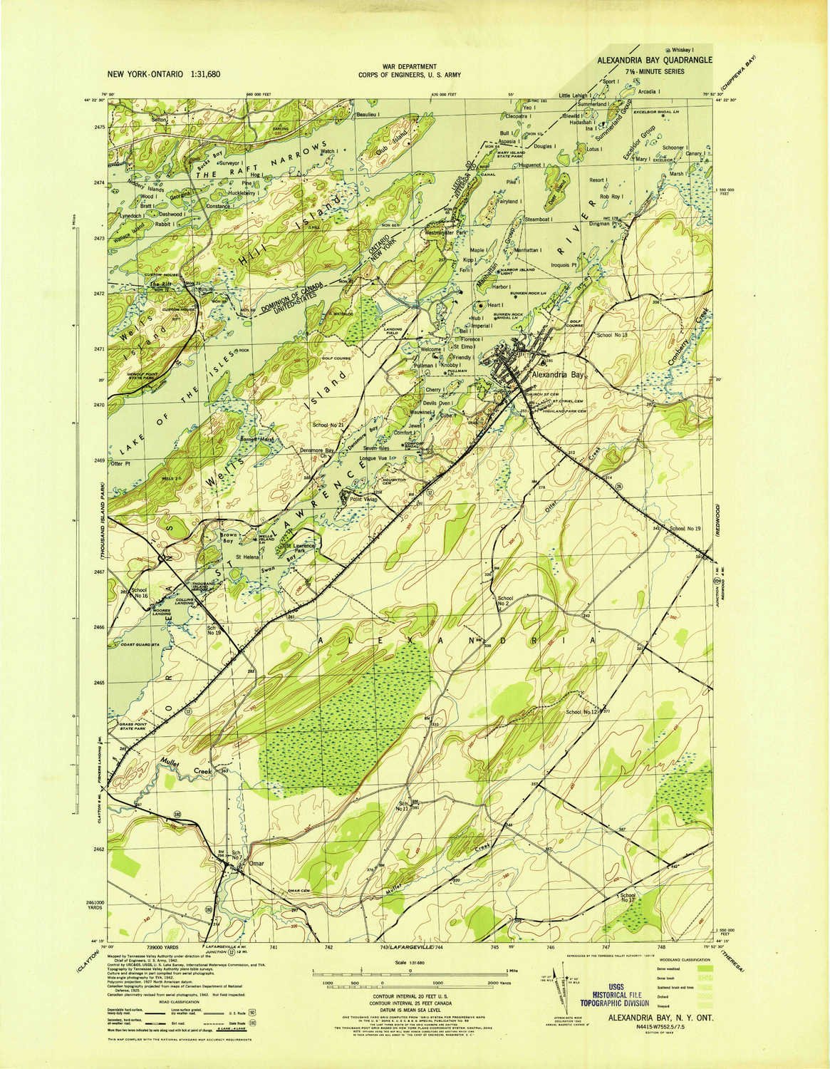
USGS topographic map of Alexandria Bay, NY, at 1:31680 scale. Heavier material. Waterproof. Tear-resistant. Foldable. Perfect for the outdoors.
Cities, towns, villages: Alexandria Bay,Edgewood Park,Moore Landing,Alexandria Center,Omar,Pinehurst Resort,Saint Lawrence Park,Collins Landing,Point Vivian,Godfreys Corner,Westminster Park
Islands: Sand Island,Kipp Island,Sunnyside Island,Idlewild Island,Canary Island,Stony Crest,Manhattan Group,Malomar Island
Parks and forests: Mary Island State Park,Grass Point State Park,Cranberry Creek Wildlife Management Area,Keewaydin Point State Park
Buy products not available in the Philippines.


