Galleon 2025Download our mobile shopping application for faster and easy transaction.
Product ID:
134097
Identifier:
156695326X
Brand:
National Geographic
Model:
NatGeo Maps: Trails Illustrated
Shipping Weight:
0.2 lbs
Manufacturer:
National Geographic Maps
Shipping Dimension:
9.21 x 4.25 x 0.24 inches
₱1,411
₱1,317
+ ₱ 150
Shipping Cost from USA to Philippines inclusive of custom fees.
Cost too high? Check weight and dimension on product details and click "I think this is wrong?" link.
Get it between 2025-11-12 to 2025-11-19.
Additional 3 business days for provincial shipping.
- Price and Stocks may change without prior notice
- Packaging of actual item may differ from photo shown
Cash upon Pick-up - orders grand total must not exceed ₱5,000.00. Order will be pickup at Galleon's Office.
Cash on Delivery - orders grand total must not exceed of ₱10,000.00 and must not exceed ₱5,000.00 for provincial areas. See all payment methods
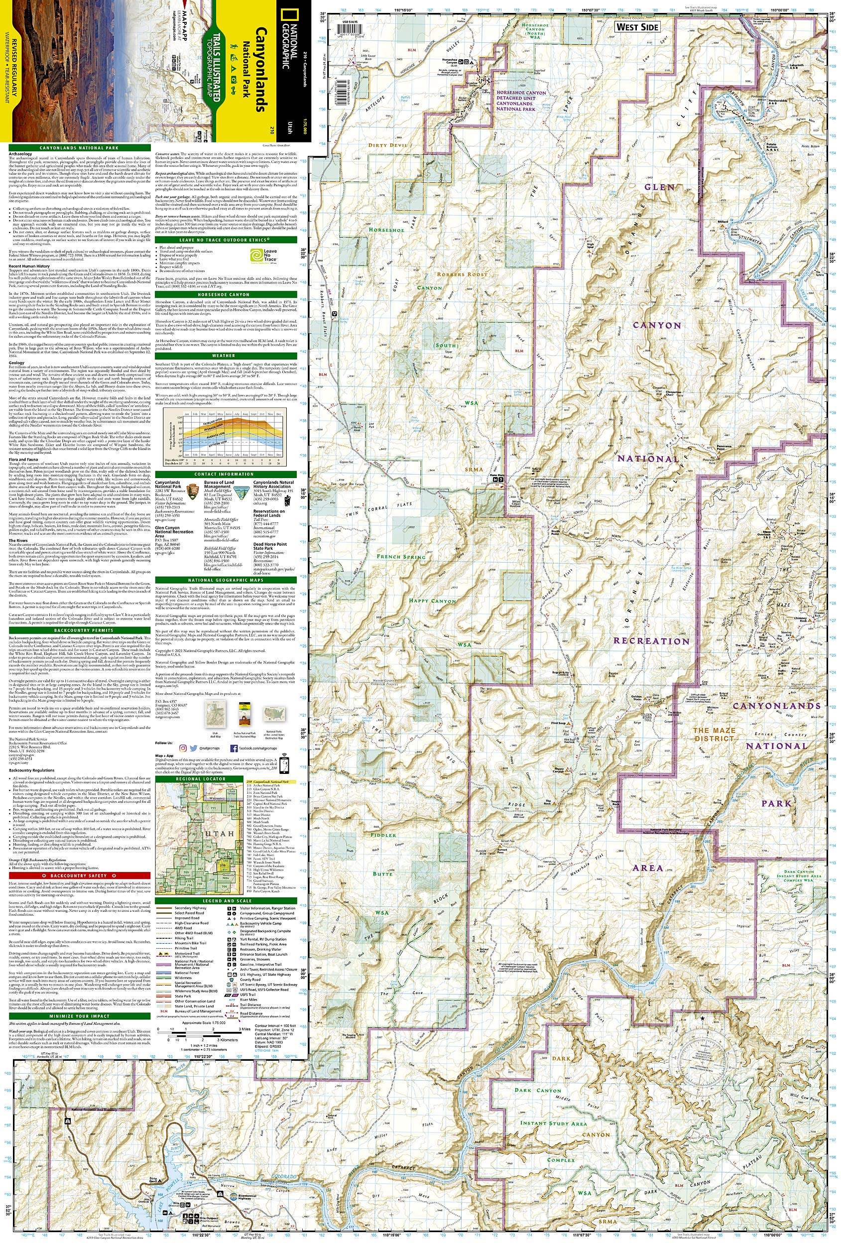
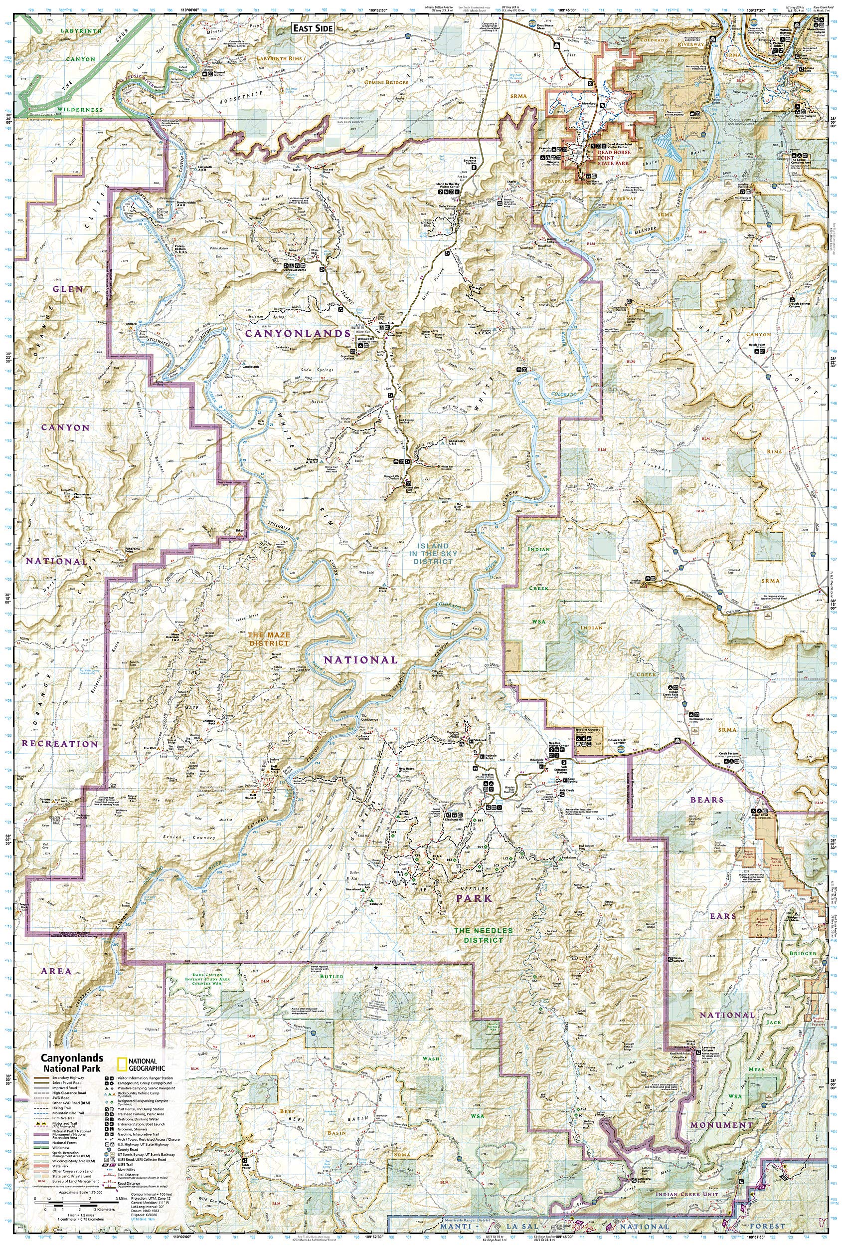
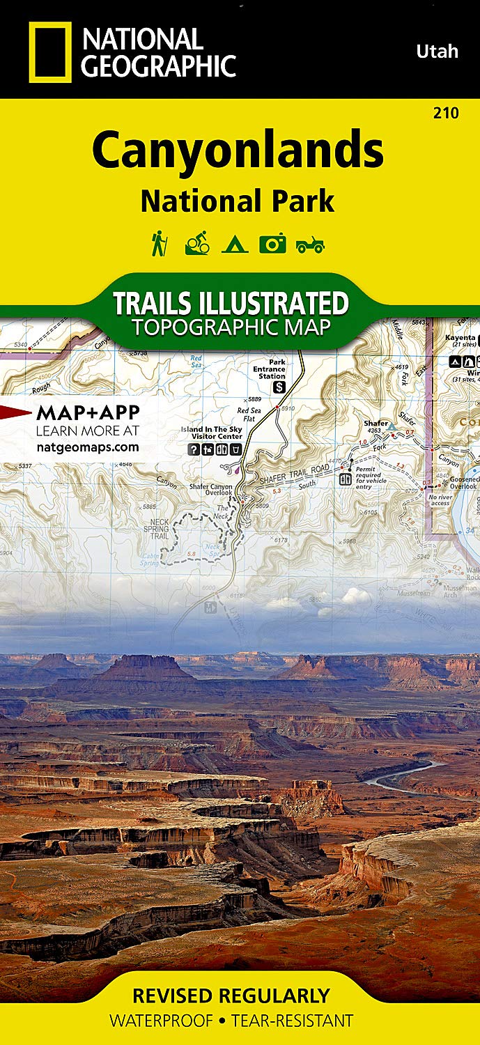
Approximately 4 1/4" x 9" folded; 25 1/2" x 37 3/4" fully opened
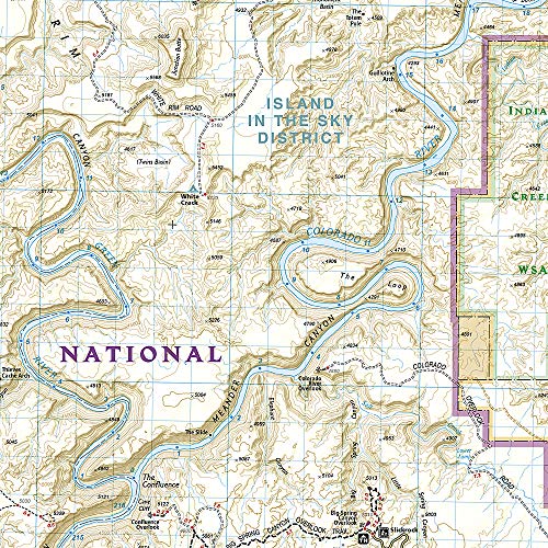
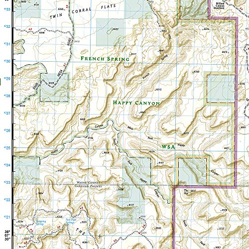
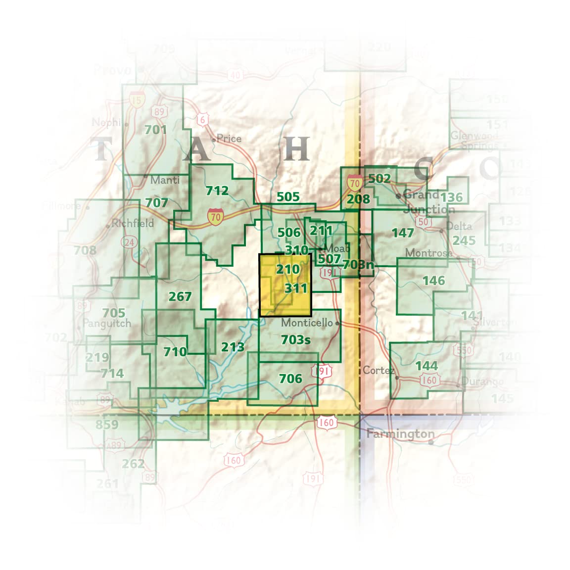
• Waterproof • Tear-Resistant • Topographic Map National Geographic's Trails Illustrated map of Canyonlands National Park is designed to meet the needs of outdoor enthusiasts by combining valuable information with unmatched detail of this mesmerizing landscape of river canyons and fantastically formed buttes. Expertly researched and created in partnership with local land management agencies, this map is loaded with helpful information on the park's archaeology, Glen Canyon, Horseshoe Canyon, backcountry safety, park regulations and more. Key areas of interest featured on this map include Canyon Rims Recreation Area; Glen Canyon National Recreation Area; the Island in the Sky district; the Needles district; and the Maze district. With miles of clearly marked trails that include mileages between intersections, this map will prove invaluable in your exploration of the park. River mileage on the Colorado and Green rivers is noted as well, for those exploring the winding river canyons by boat. Some of the many recreation features include visitor centers, campgrounds, points of interest, scenic overlooks, and boat launch sites. The map base includes contour lines and elevations for summits and passes. Every Trails Illustrated map is printed on "Backcountry Tough" waterproof, tear-resistant paper. A full UTM grid is printed on the map to aid with GPS navigation. Other features found on this map include: Canyonlands National Park, Glen Canyon National Recreation Area, Green River, Orange Cliffs, Soda Springs Basin. Map Scale = 1:75,000 Sheet Size = 25.5" x 37.75" Folded Size = 4.25" x 9.25"
Buy products not available in the Philippines.