Galleon 2025Download our mobile shopping application for faster and easy transaction.
Product ID:
134111
Identifier:
1597756261
Brand:
National Geographic
Model:
TI0000725
Shipping Weight:
0.2 lbs
Manufacturer:
National Geographic Maps
Shipping Dimension:
9.37 x 4.29 x 0.28 inches
₱1,411
₱1,201
+ ₱ 150
Shipping Cost from USA to Philippines inclusive of custom fees.
Cost too high? Check weight and dimension on product details and click "I think this is wrong?" link.
Get it between 2025-11-19 to 2025-11-26.
Additional 3 business days for provincial shipping.
- Price and Stocks may change without prior notice
- Packaging of actual item may differ from photo shown
Cash upon Pick-up - orders grand total must not exceed ₱5,000.00. Order will be pickup at Galleon's Office.
Cash on Delivery - orders grand total must not exceed of ₱10,000.00 and must not exceed ₱5,000.00 for provincial areas. See all payment methods
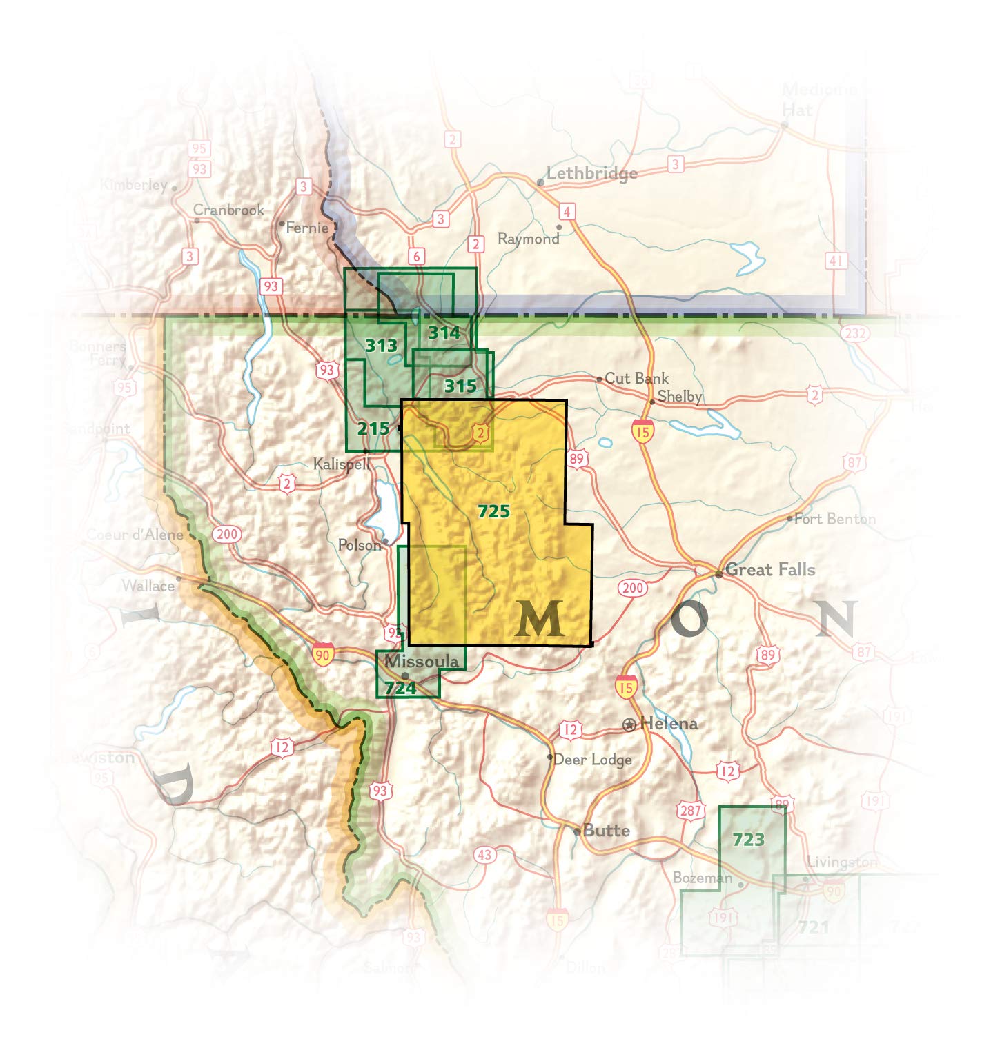
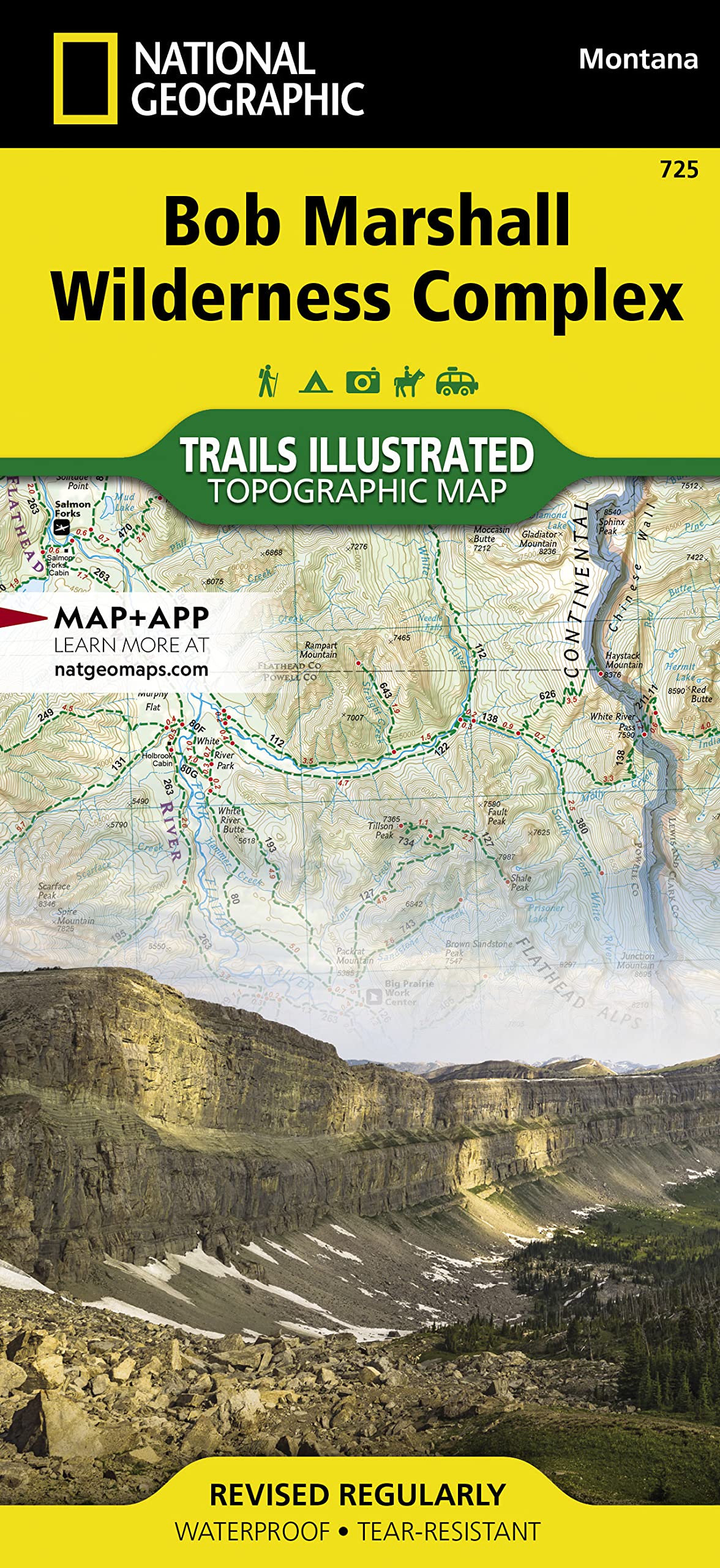
Explore the wonders of the Bob Marshall Wilderness Complex with National Geographics Bob Marshall Wilderness Trails Illustrated Map. This area includes four national forests and the Great Bear, Bob Marshall, and Scapegoat Wilderness Areas. Encompassing th
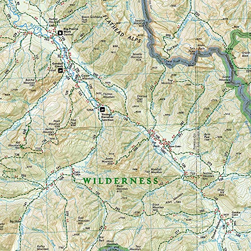
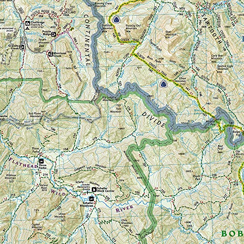
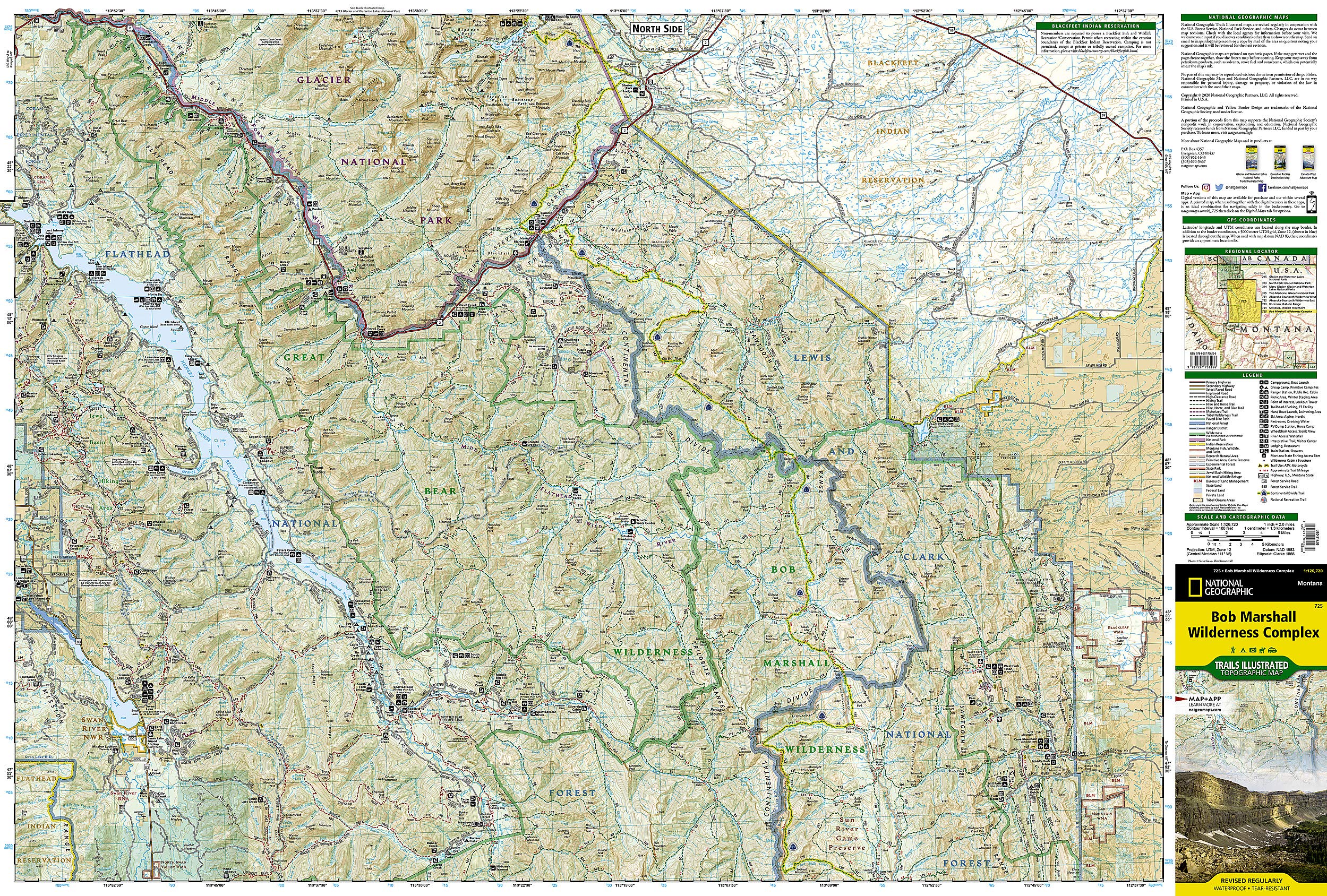
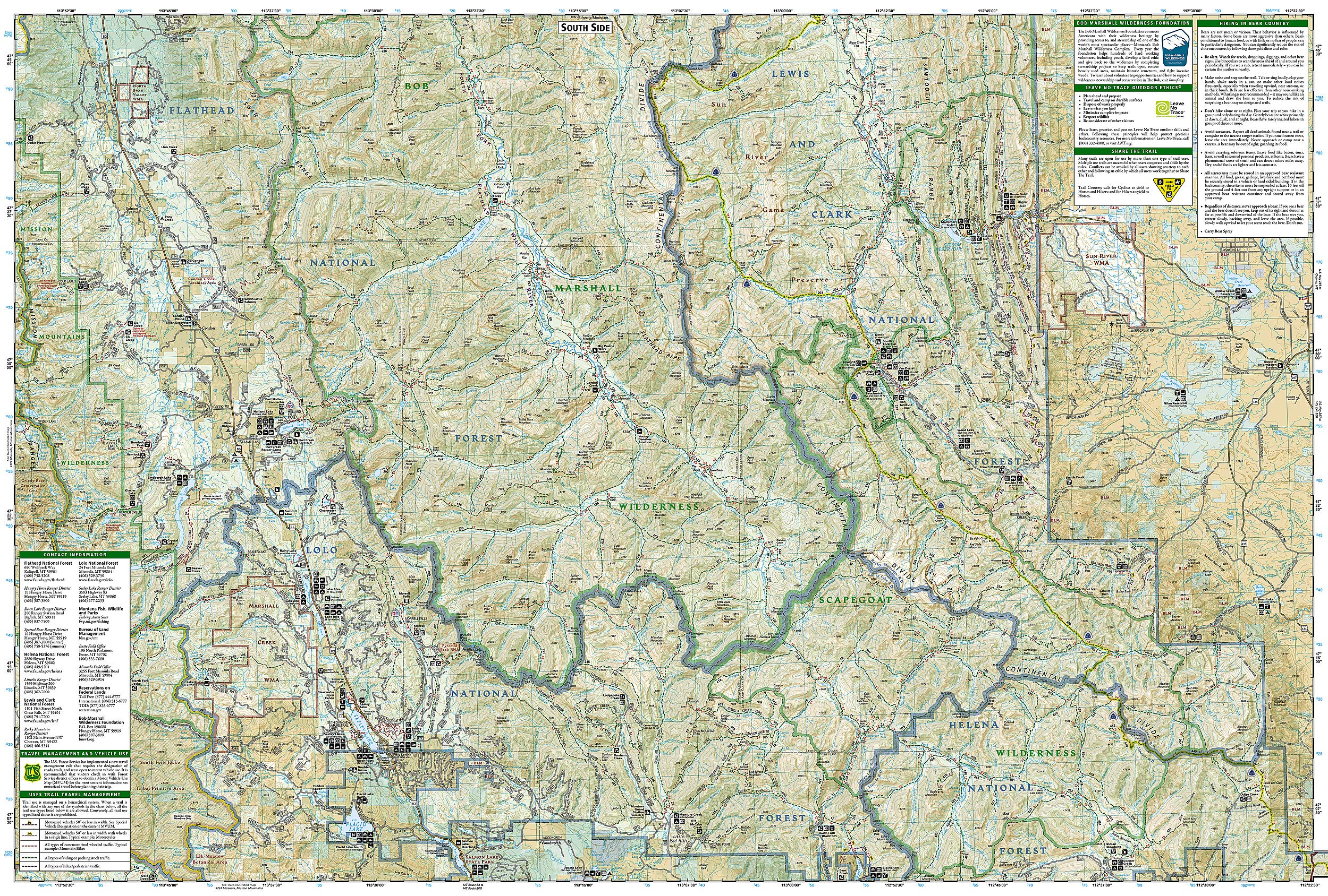
• Waterproof • Tear-Resistant • Topographic Map Explore the wonders of the Bob Marshall Wilderness Complex with National Geographic's Bob Marshall Wilderness Trails Illustrated Map. This area includes four national forests and the Great Bear, Bob Marshall, and Scapegoat Wilderness Areas. Encompassing the highest concentration of grizzlies in the continental U.S., this region extends from Seeley Lake in the South to the northern tip of Hungry Horse Reservoir and spreads East to Glacier National Park, with all of Sun Valley on the West. This expertly researched and highly detailed map includes the Flathead and Swan Mountain Ranges, the "Chinese Wall" along the Continental Divide, the renowned Jewel Basin, and the Sun River Game Preserve. Also depicted are the South Fork and the southern section of the Middle Fork of the Flathead Wild River. This map will guide you through stunning wilderness with miles of mapped trails and clearly marked trailheads. Every Trails Illustrated map is printed on "Backcountry Tough" waterproof, tear-resistant paper. A full UTM grid is printed on the map to aid with GPS navigation. A portion of the proceeds from the purchase of a National Geographic map help support the Society's vital exploration, conservation, scientific research, and education programs. Other features found on this map include: Augusta, Choteau Mountain, Condon, East Glacier Park, Essex, Flathead Alps, Flathead National Forest, Flathead Range, Four Horns Lake, Gibson Reservoir, Gilman, Holland Peak, Lewis and Clark Range, Marmot Mountain, McDonald Peak, Mission Range, Mount Baptiste, Mount Saint Nicholas, Ovando Mountain, Pentagon Mountain, Pinnacle, Pishkun National Wildlife Refuge, Placid Lake, Red Mountain, Sawtooth Range, Scarface Peak, Seeley Lake, Silvertip Mountain, Swan Lake, Swan Range, Willow Creek National Wildlife Refuge. Map Scale = 1:126,720 Sheet Size = 25.5" x 37.75" Folded Size = 4.25" x 9.25"
Buy products not available in the Philippines.