Galleon 2025Download our mobile shopping application for faster and easy transaction.
Product ID:
191058
Identifier:
1566952395
Brand:
National Geographic
Model:
Shipping Weight:
0.2 lbs
Manufacturer:
Natl Geographic Society Maps
Shipping Dimension:
7.32 x 5.83 x 0.39 inches
₱1,411
+ ₱ 150
Shipping Cost from USA to Philippines inclusive of custom fees.
Cost too high? Check weight and dimension on product details and click "I think this is wrong?" link.
Get it between 2025-11-19 to 2025-11-26.
Additional 3 business days for provincial shipping.
- Price and Stocks may change without prior notice
- Packaging of actual item may differ from photo shown
Cash upon Pick-up - orders grand total must not exceed ₱5,000.00. Order will be pickup at Galleon's Office.
Cash on Delivery - orders grand total must not exceed of ₱10,000.00 and must not exceed ₱5,000.00 for provincial areas. See all payment methods
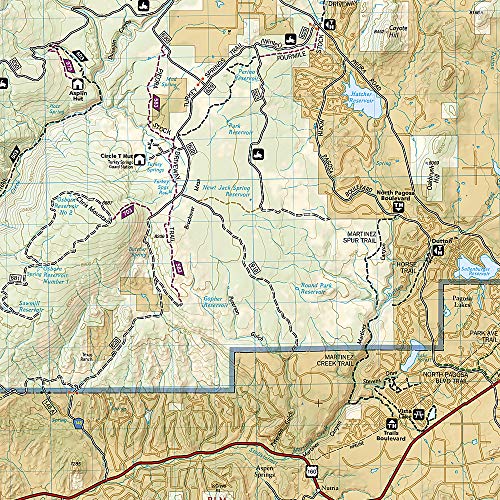
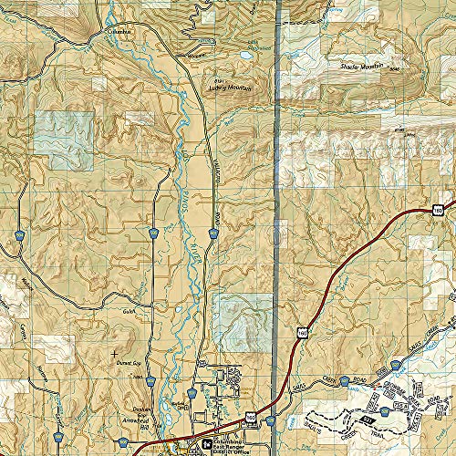
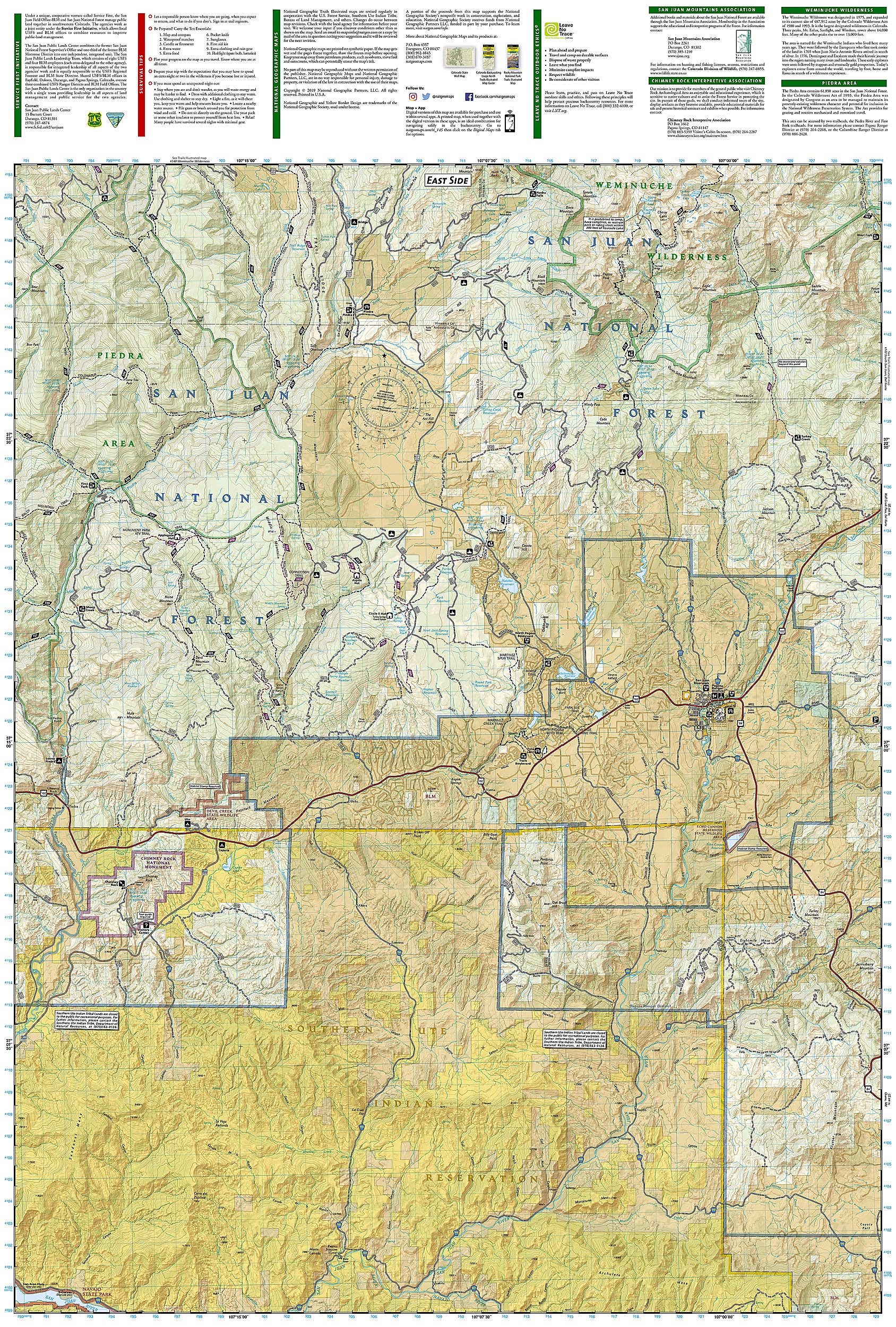
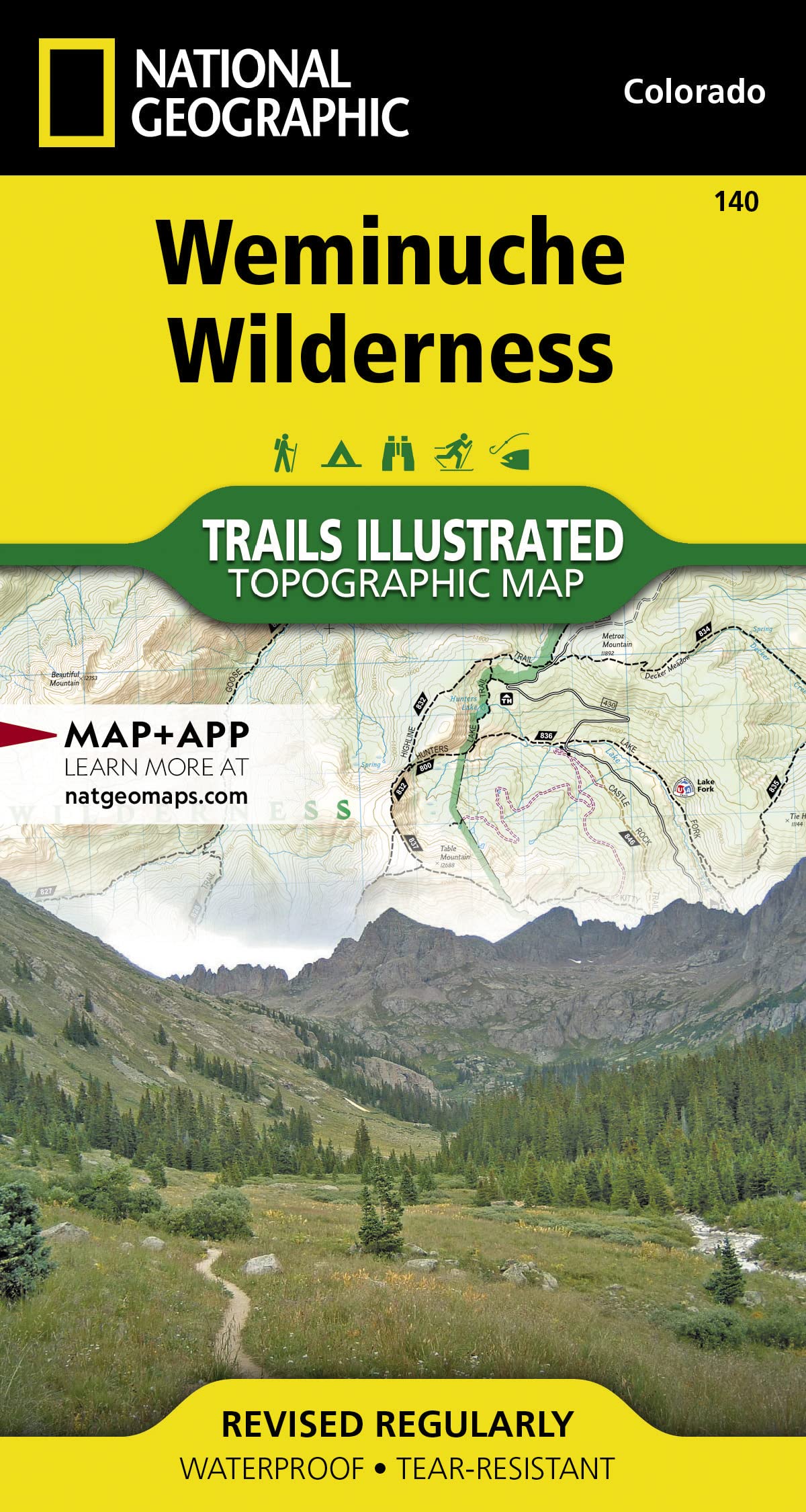
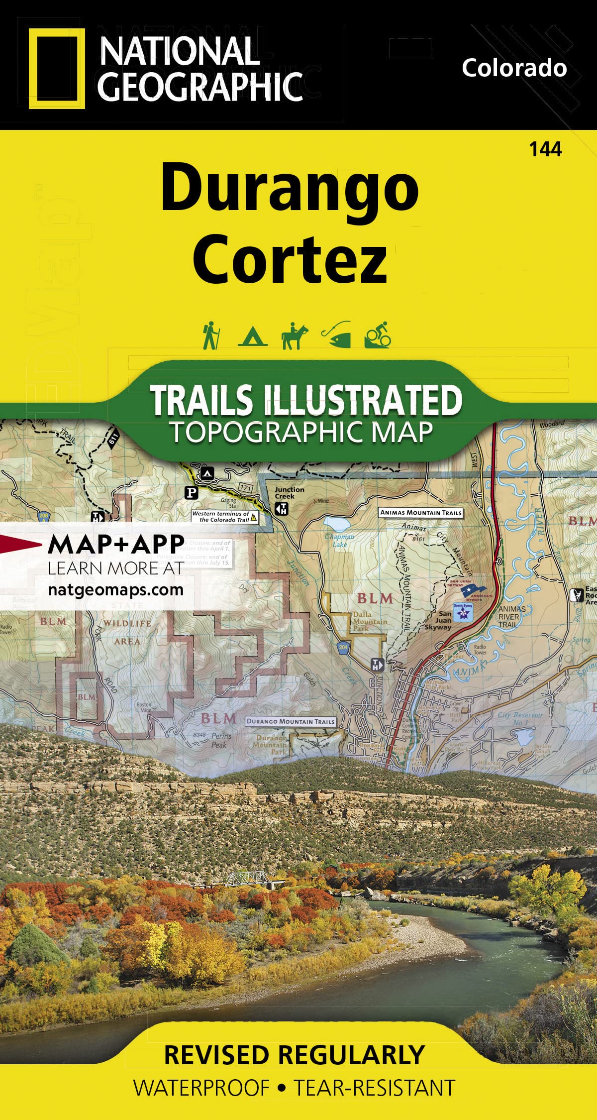
• Waterproof • Tear-Resistant • Topographic Map National Geographic's Trails Illustrated map of Pagosa Springs and Bayfield provides unparalleled detail of this area on the western slope of the Continental Divide in southwestern Colorado. Expertly researched and created in partnership with the U.S. Forest Service, Southern Ute Indian Tribe, Bureau of Land Management and others, the map's coverage includes San Juan National Forest, Piedra Area and River, Vallecito and Lemon Reservoirs, Chimney Rock National Monument and Southern Ute Indian Reservation. Get off the beaten path and back on again by following the map to trailheads and then along trails that are labeled according to their designated usage. High clearance and four-wheel drive roads are marked as well. To aid in your navigation, the map includes contour lines, elevations, labeled peaks, water features, waypoints, and clear boundaries between national park and Indian land, which is closed to the public for recreational purposes. Many recreation points of interest, for all seasons, are clearly noted, including campgrounds and campsites, cross-country ski areas and snowmobile trails, boat launch and river access points, fishing areas, scenic viewpoints and wildlife viewing areas. In addition, the map provides background information of the area, survival tips and contact information of both public and private organizations involved in maintaining the region. Every Trails Illustrated map is printed on "Backcountry Tough" waterproof, tear-resistant paper. A full UTM grid is printed on the map to aid with GPS navigation. Other features found on this map include: Mesa Mountains, Navajo River, San Juan National Forest, Vallecito Reservoir, Weminuche Wilderness. Map Scale = 1:63,360 Sheet Size = 25.5" x 37.75" Folded Size = 4" x 7.5"
Buy products not available in the Philippines.