Galleon 2025Download our mobile shopping application for faster and easy transaction.
Product ID:
75109
Identifier:
B0FBRT378W
Brand:
NiesahYan
Model:
Shipping Weight:
0.9 lbs
Manufacturer:
NiesahYan
Shipping Dimension:
7.01 x 2.01 x 0.98 inches
₱8,680
₱12,015
+ ₱ 434
Shipping Cost from USA to Philippines inclusive of custom fees.
Cost too high? Check weight and dimension on product details and click "I think this is wrong?" link.
Get it between 2025-11-16 to 2025-11-23.
Additional 3 business days for provincial shipping.
- Price and Stocks may change without prior notice
- Packaging of actual item may differ from photo shown
Cash upon Pick-up - orders grand total must not exceed ₱5,000.00. Order will be pickup at Galleon's Office.
Cash on Delivery - orders grand total must not exceed of ₱10,000.00 and must not exceed ₱5,000.00 for provincial areas. See all payment methods
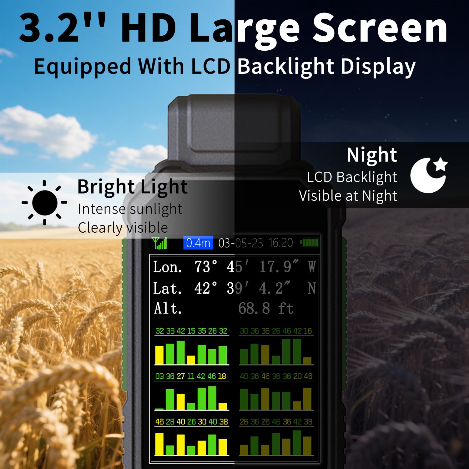
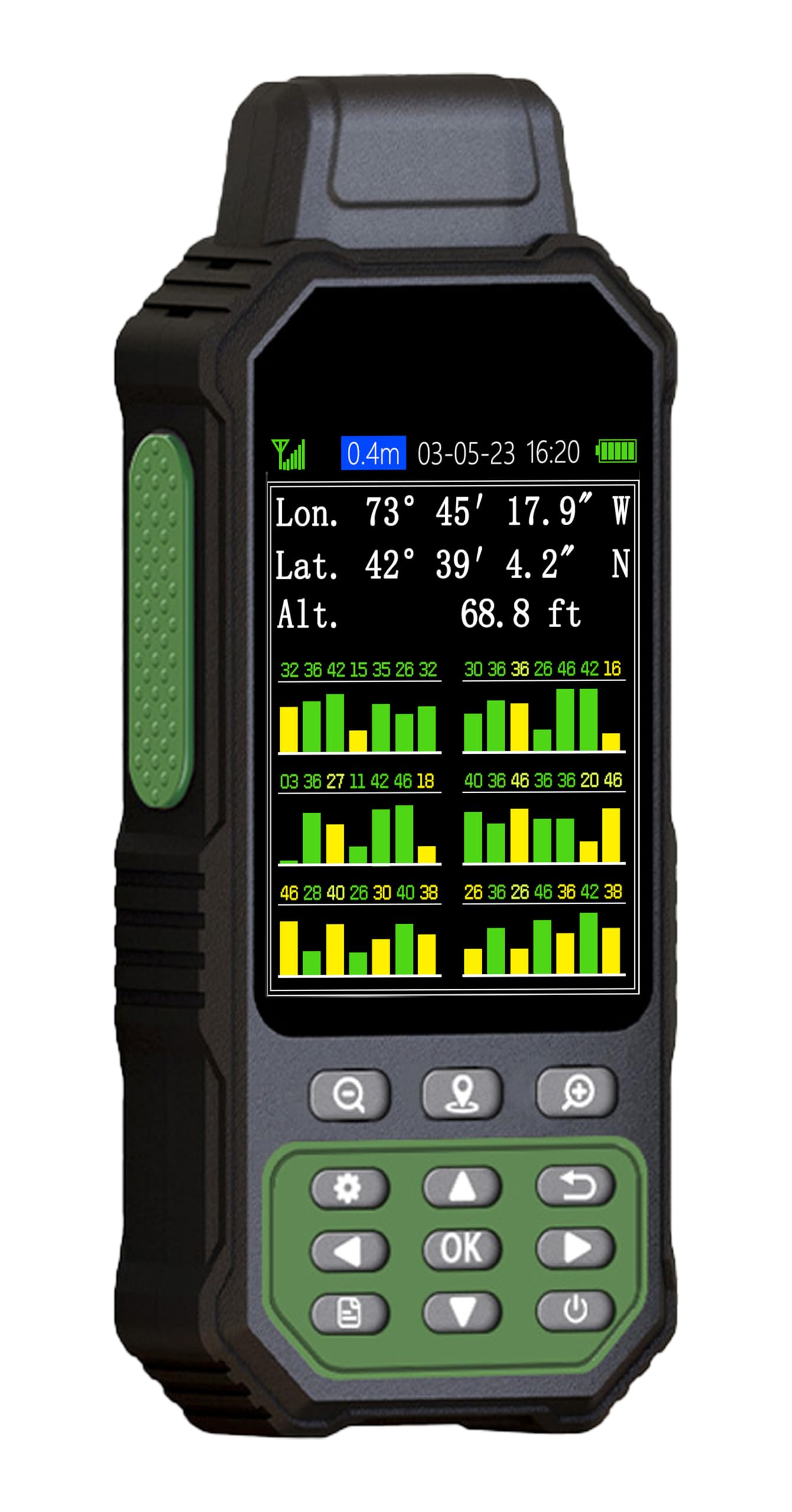
LARGE SCREEN:Large 3.2" sunlight-readable color display with 240 x 320 display pixels for improved readability,even in bright sunlight
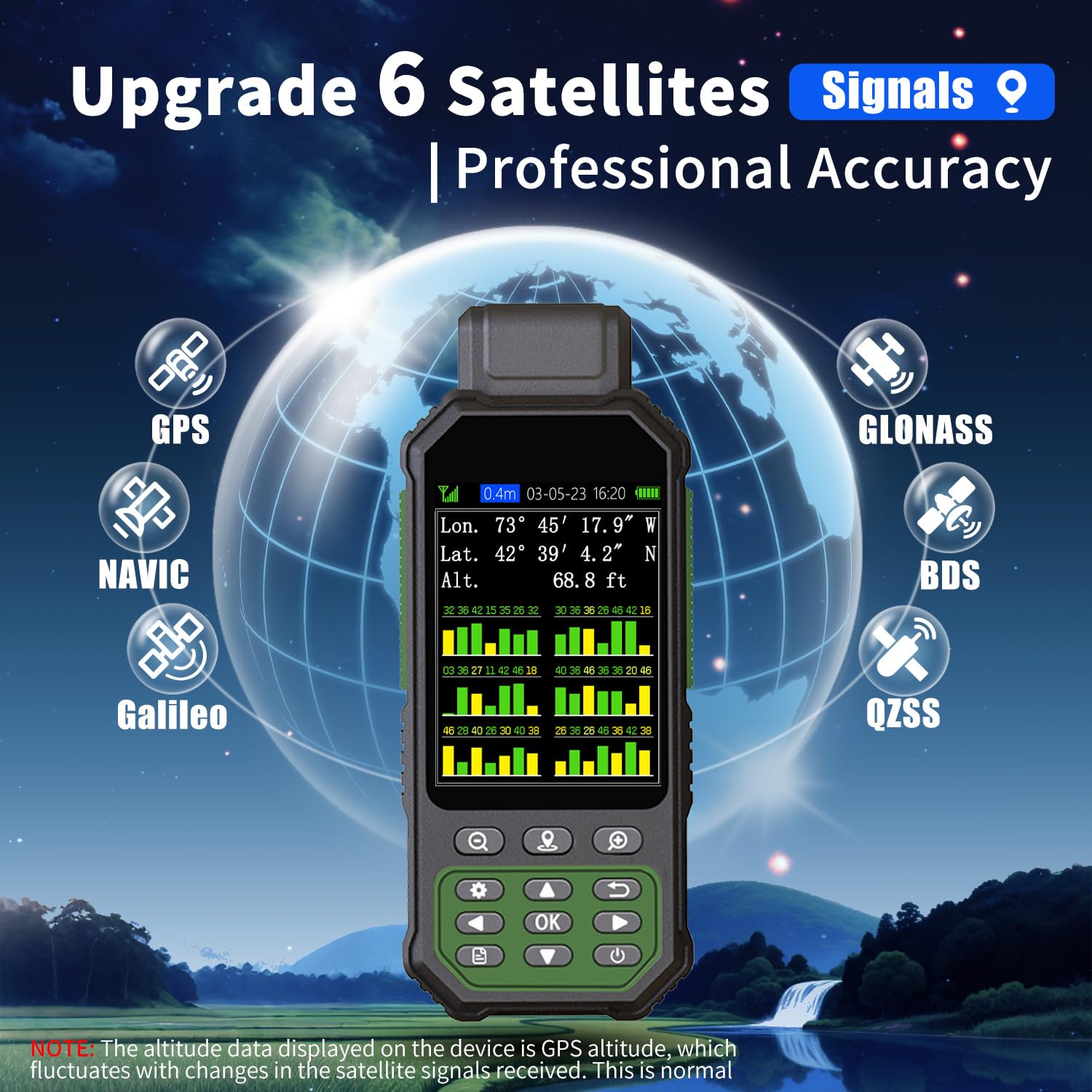
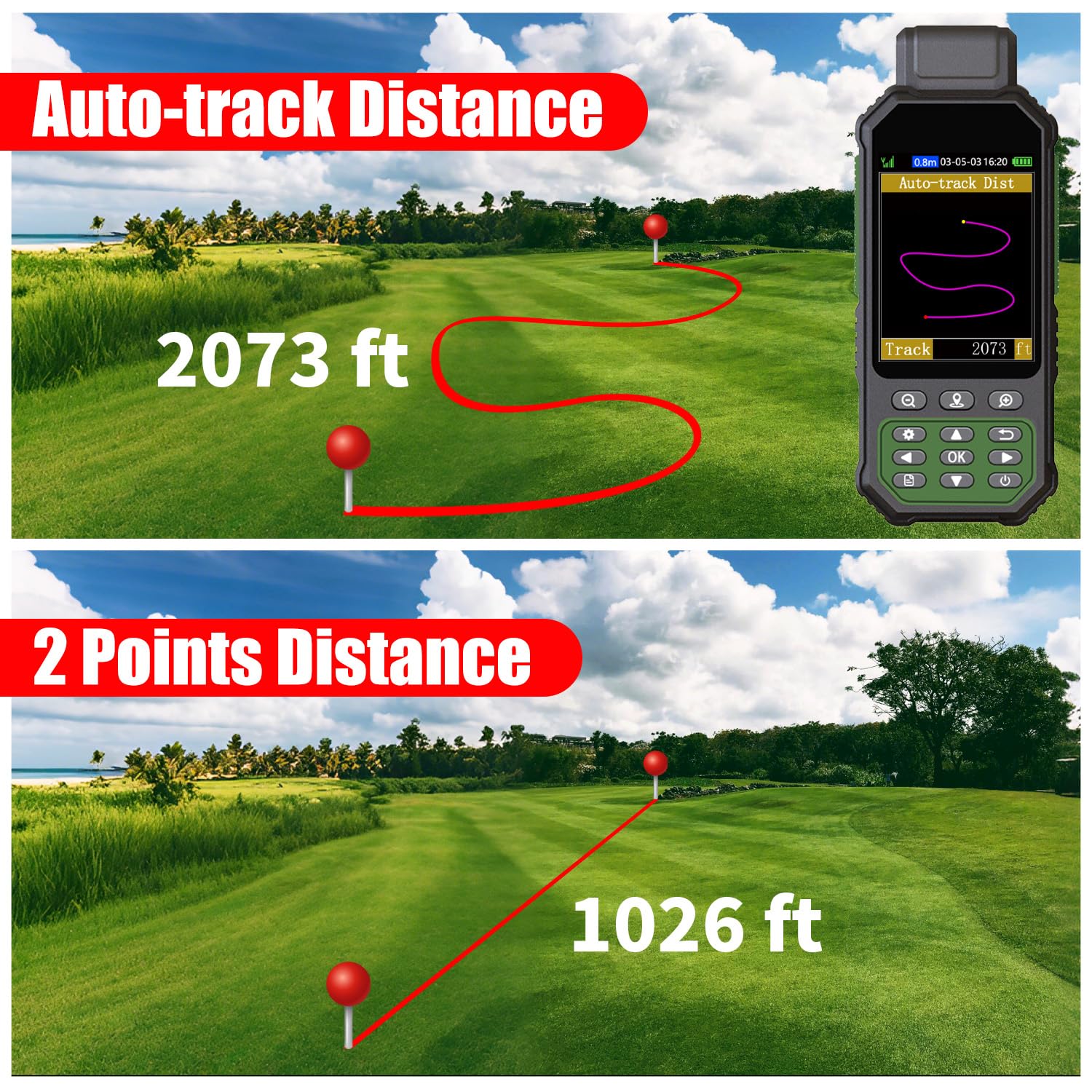
PROFESSINAL ACCURACY: Supports 6 satellite systems (GPS, Beidou, Galileo,GLONASS, NAVIC and QZSS ) for high presion measurement, area error < 0.002 acres,distance error < 5 ft
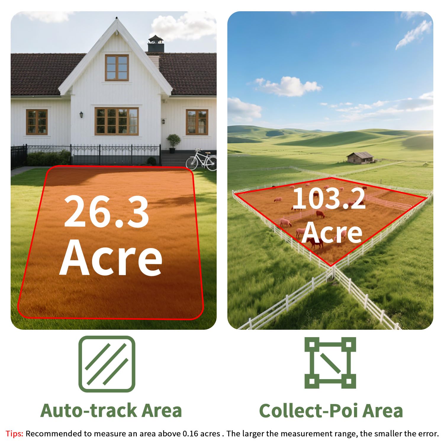
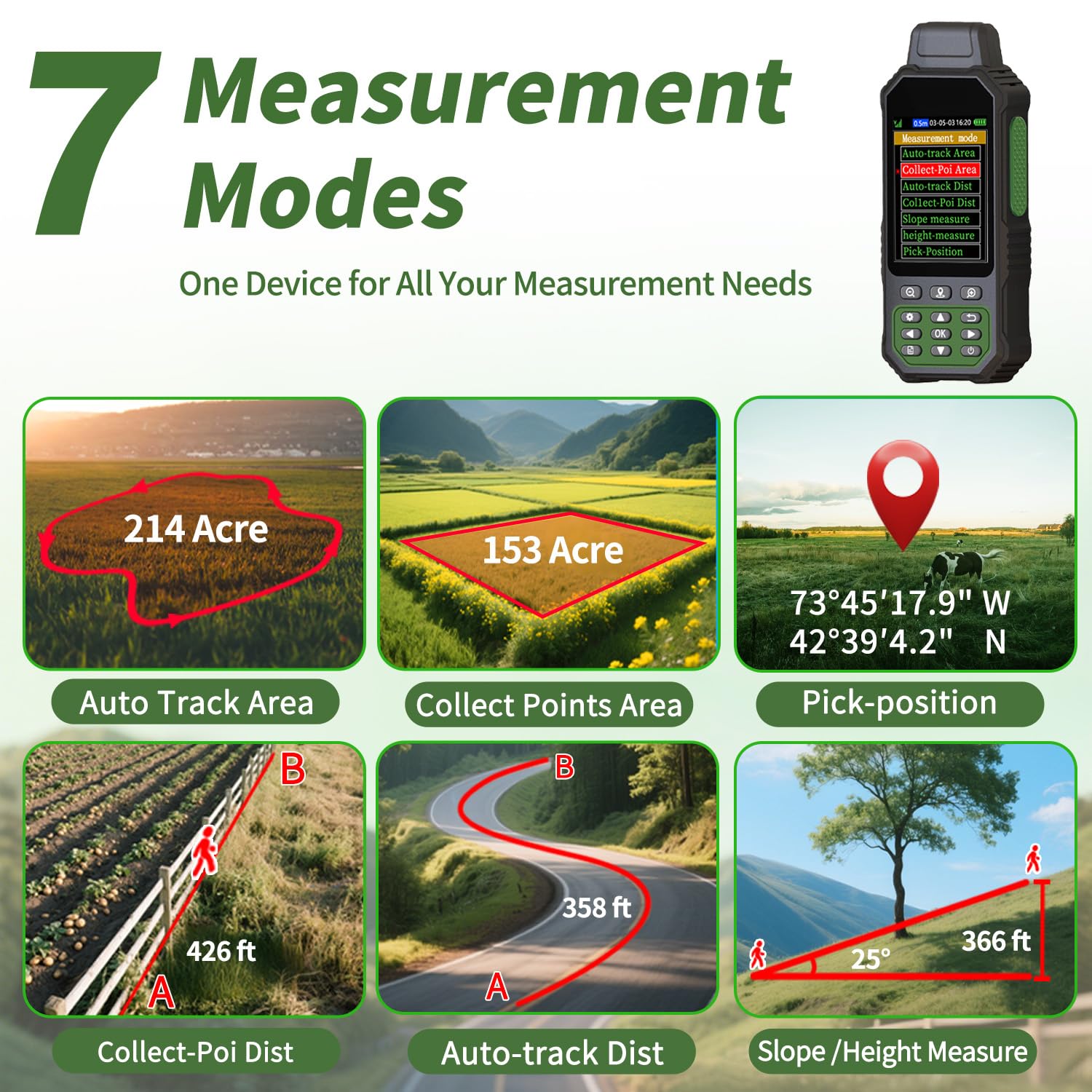
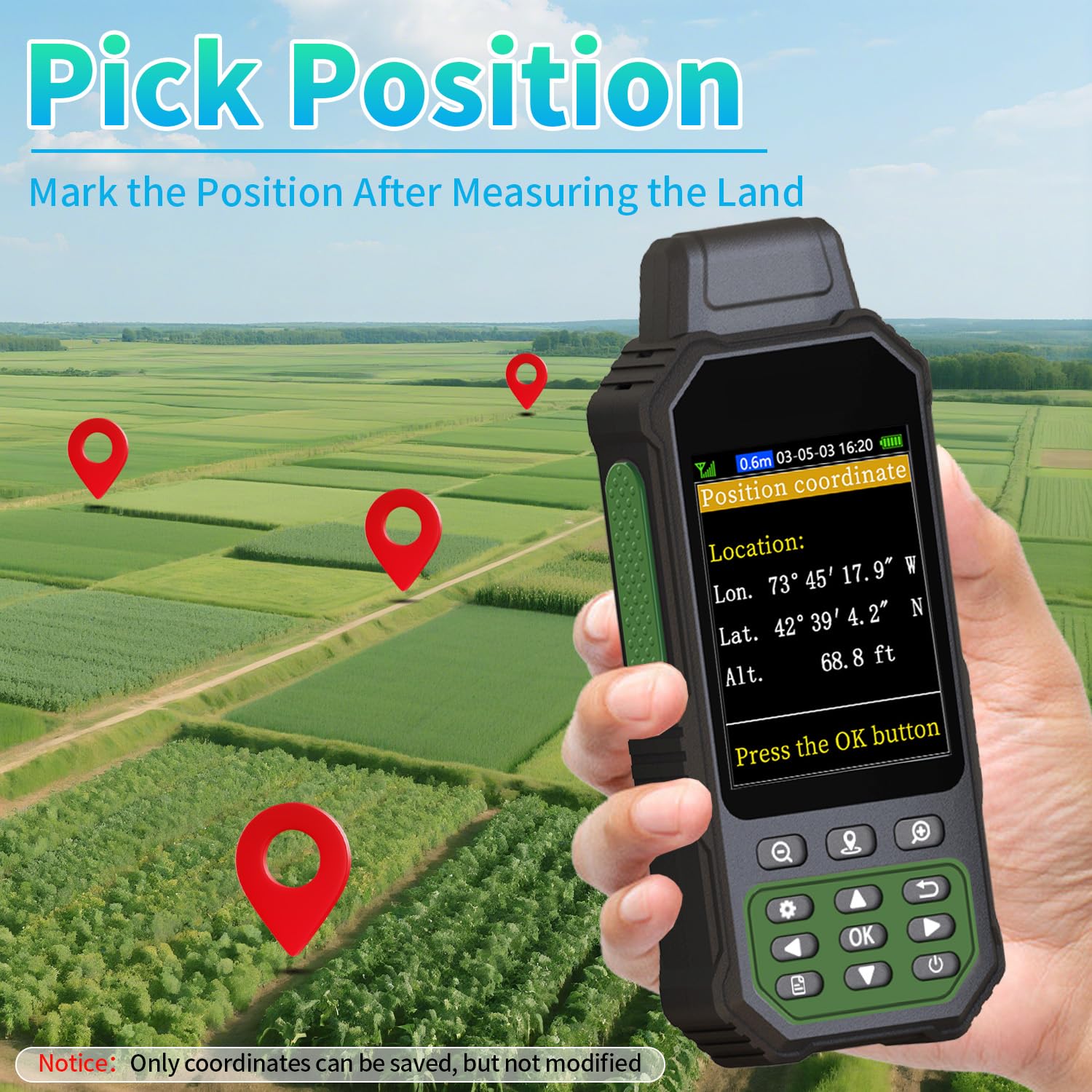
7 MEASUREMENT FEATURES: Offer measurement features such as flat area, slope area, rectangular area, irregular area,curve line distance, straight line distance and measure height,it aslo can save coordinats points of the terrin(Only coordinates can be saved, but not modified)
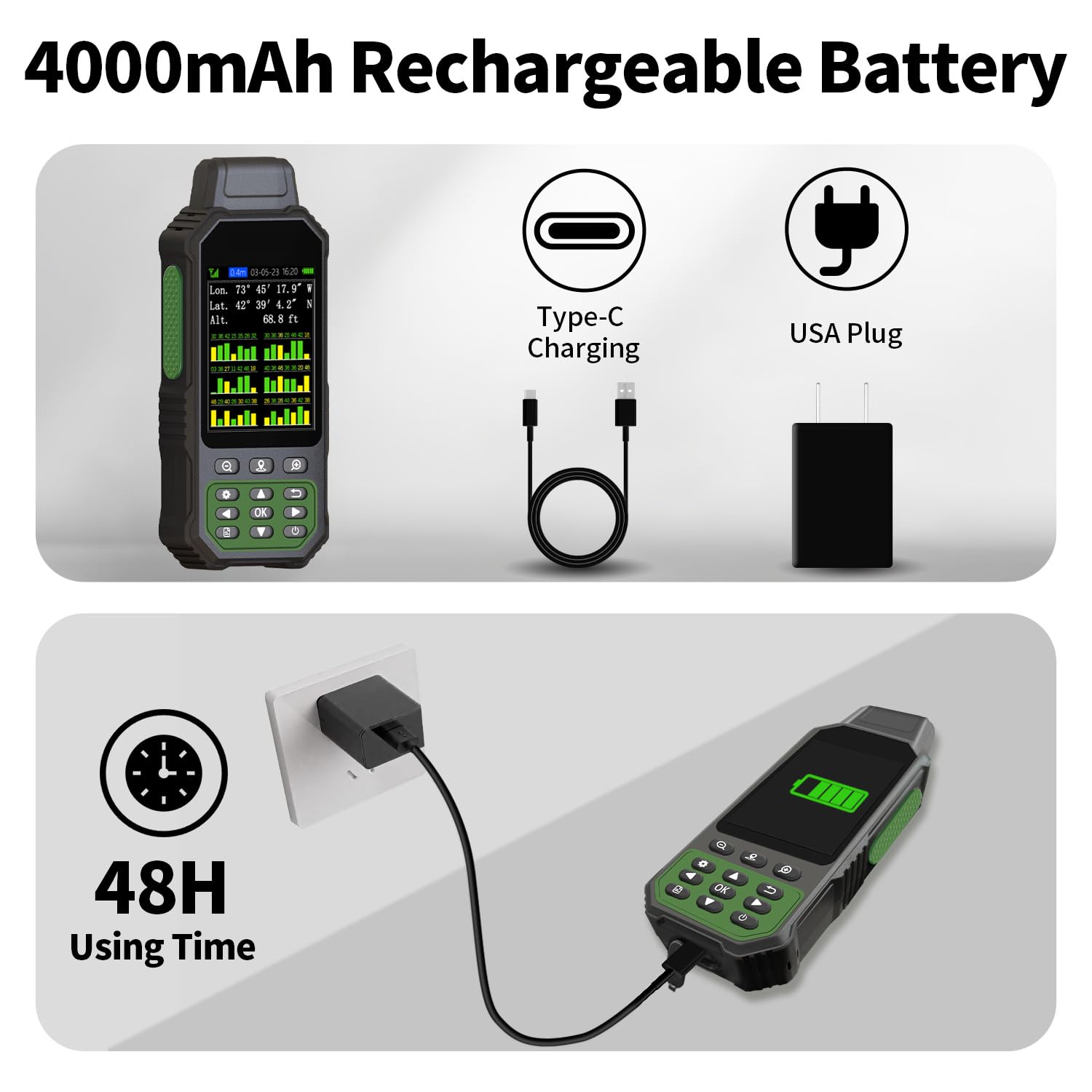
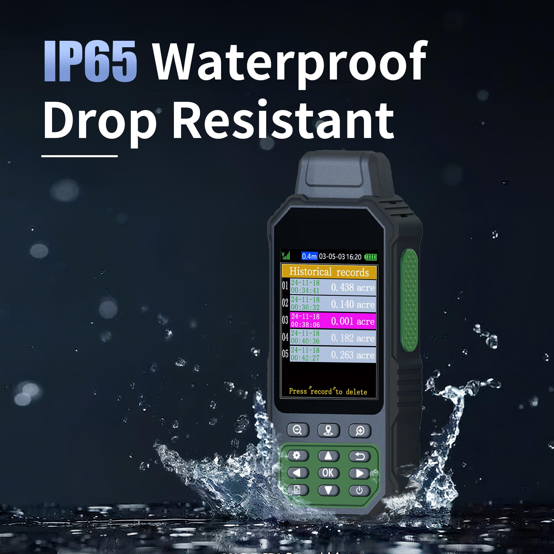
RUGGED WITH LONG BATTERY LIFE: IP65-rated for superior durability; powered by internal 4000 mAh Li-ion rechargeable battery, up to 48 hours in continuous use
EASY TO USE: Intuitive user interface with backlit buttons for quick and easy operation. The device needed to be held horizontal for taking measurements. Recommended to measure an area above 0.16 acres and distance above 328 ft. The larger the measurement range, the smaller the error
NOTE: Please search satellite signals in an open outdoor area before using the machine. When the signal value in the upper left corner of the machine screen is below 1 m, start using to ensure the accuracy of the machine. This machine can only be used for surveying and cannot be used for navigation! The altitude data displayed on the device is GPS altitude, which fluctuates with changes in the satellite signals received. This is normal

Buy products not available in the Philippines.