Galleon 2026Download our mobile shopping application for faster and easy transaction.
Product ID:
846746
Identifier:
0528028774
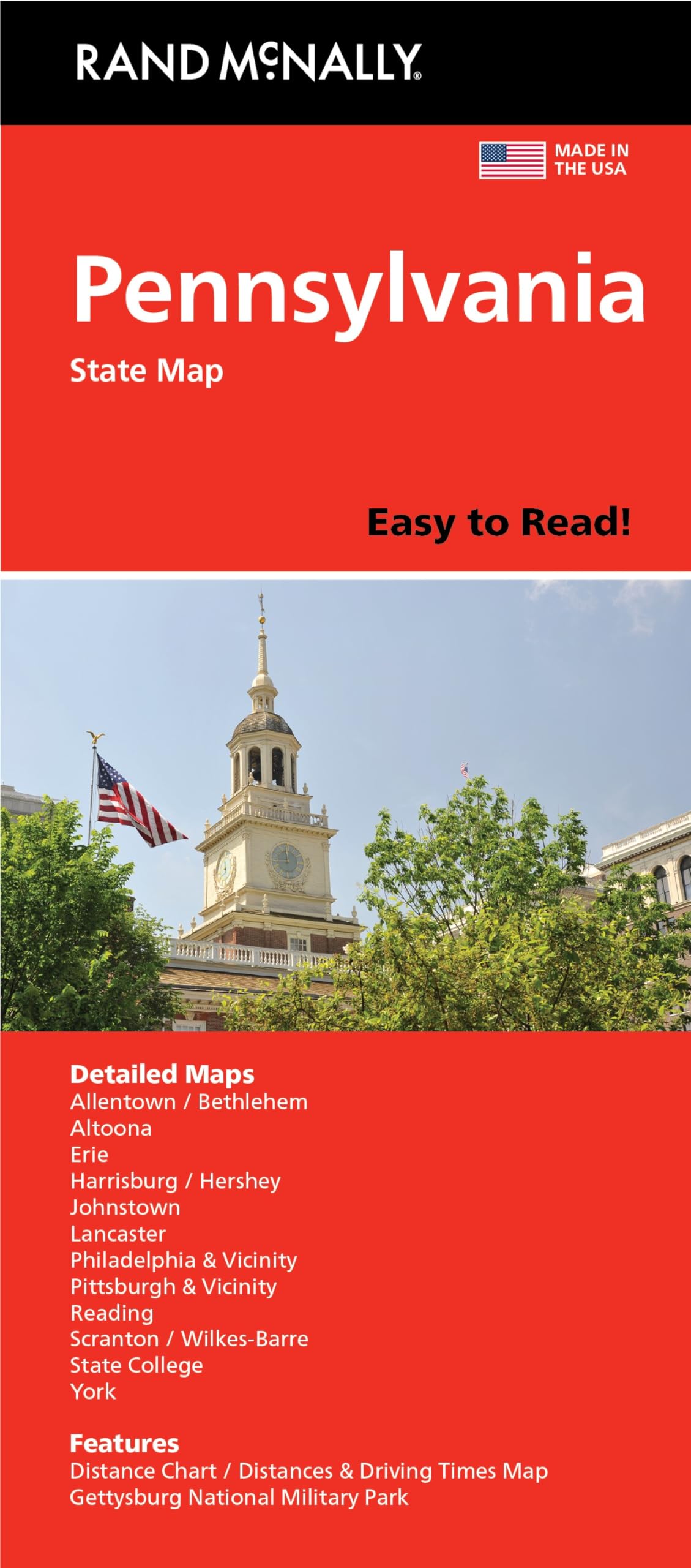
Brand:
Rand McNally
Model:
0528028774
Shipping Weight:
0.11 lbs
Manufacturer:
Rand McNally
Shipping Dimension:
9.45 x 4.09 x 0.28 inches
₱981
+ ₱ 150
Shipping Cost from USA to Philippines inclusive of custom fees.
Cost too high? Check weight and dimension on product details and click "I think this is wrong?" link.
Get it between 2026-06-08 to 2026-06-15.
Additional 3 business days for provincial shipping.
- Price and Stocks may change without prior notice
- Packaging of actual item may differ from photo shown
Cash upon Pick-up - orders grand total must not exceed ₱5,000.00. Order will be pickup at Galleon's Office.
Cash on Delivery - orders grand total must not exceed of ₱10,000.00 and must not exceed ₱5,000.00 for provincial areas. See all payment methods
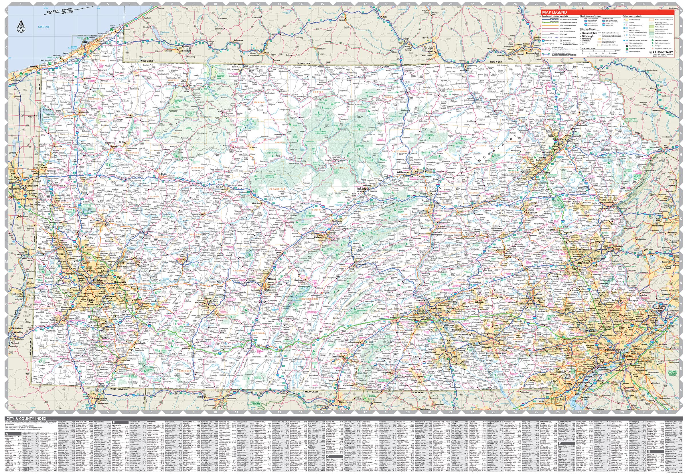
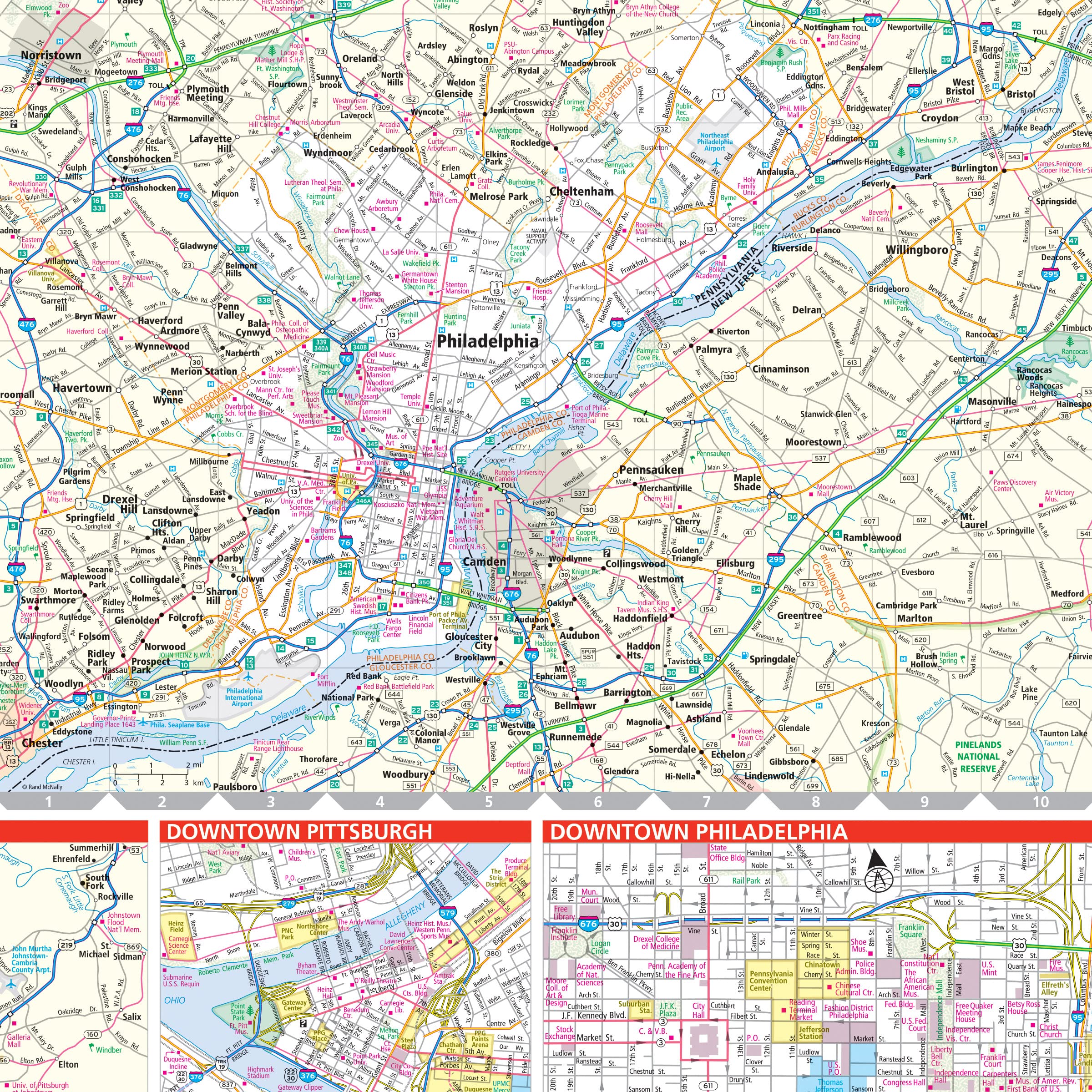
40% larger map with a bigger type size than the Rand McNally Folded Map
Regularly updated, Full-color maps
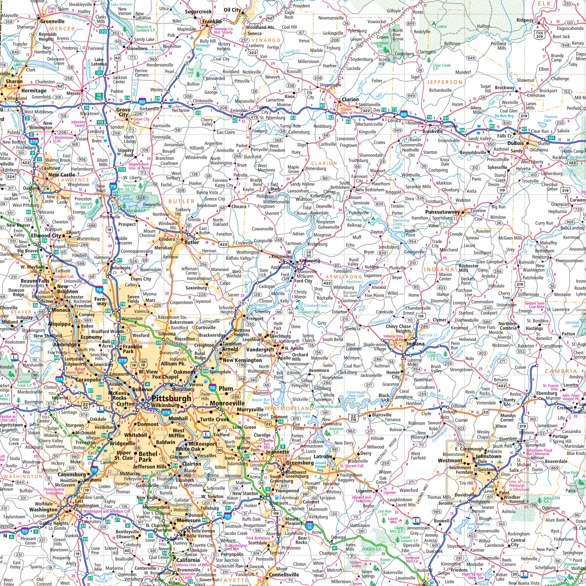
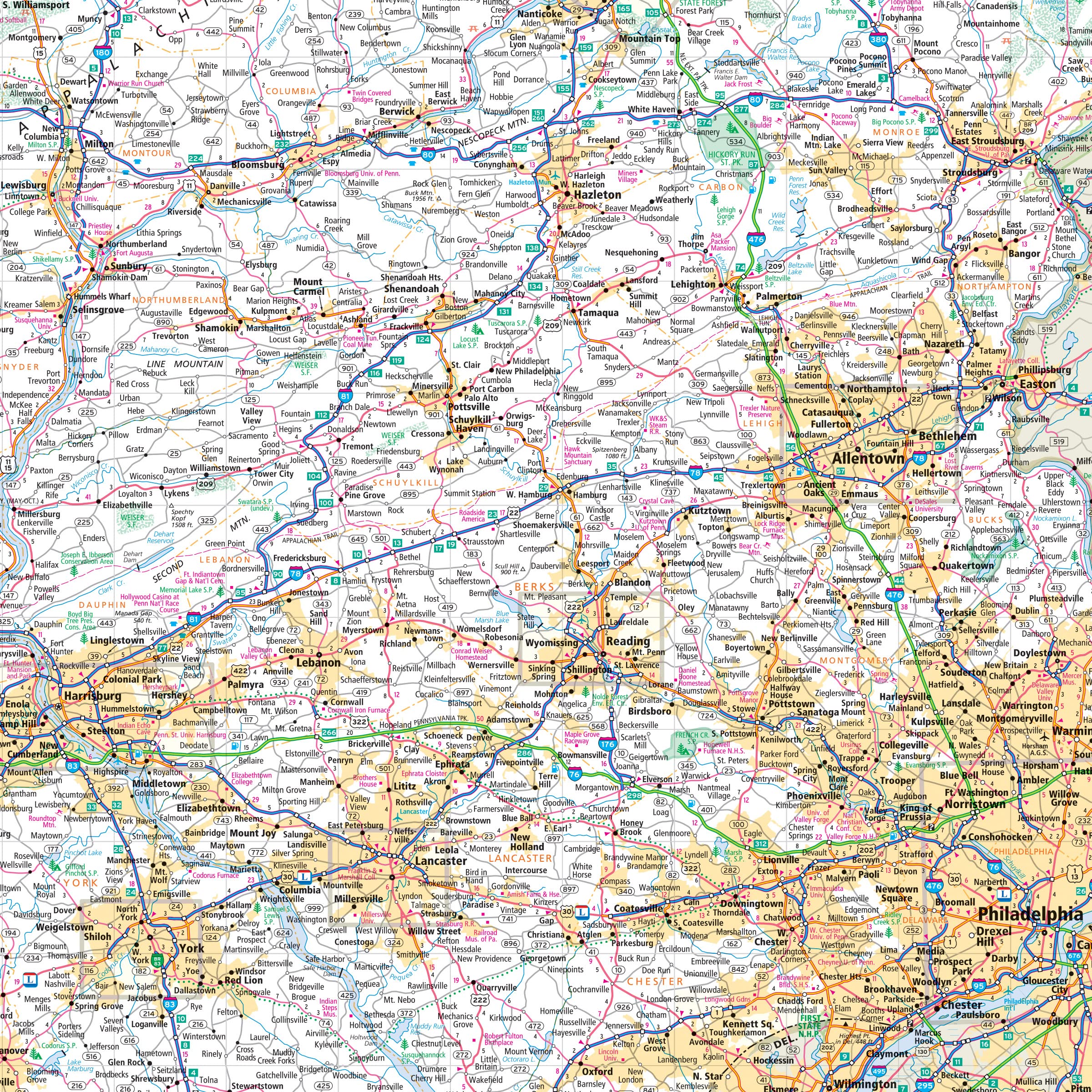
Clearly labeled Interstate, U.S., state, and county highways
Indications of parks, points of interest, airports, county boundaries, and more
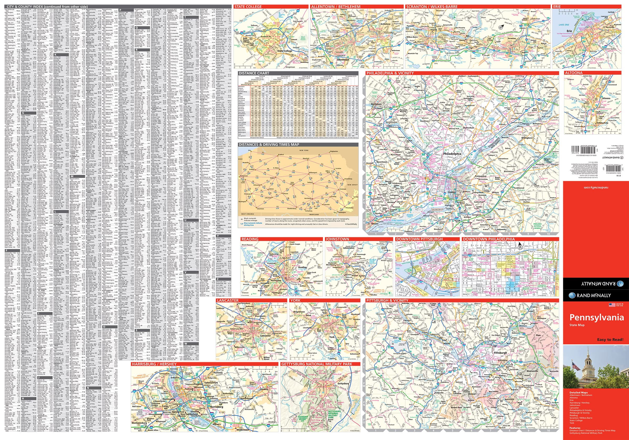
Mileage and driving times map
Detailed index
Copyright 2025
Coverage Area Detailed maps of: Allentown/Bethlehem, Altoona, Erie, Gettysburg, Harrisburg, Johnstown, Lancaster, Philadelphia & Vicinity, Downtown Philadelphia, Pittsburgh & Vicinity, Downtown Pittsburgh, Reading, Scranton/Wilkes-Barre, York
Rand McNally's Easy To Read State Folded Map is a must-have for anyone traveling in and around Pennsylvania, offering unbeatable accuracy and reliability at a great price. Our trusted cartography shows all Interstate, U.S., state, and county highways, along with clearly indicated parks, points of interest, airports, county boundaries, and streets. The easy-to-use legend and detailed index make for quick and easy location of destinations. You'll see why Rand McNally folded maps have been the trusted standard for years. - Regularly updated, full-color maps. - 40% larger map with a bigger type size than the Rand McNally Folded Map. - Clearly labeled Interstate, U.S., state, and county highways. - Indications of parks, points of interest, airports, county boundaries, and more. - Mileage and driving times map. - Detailed index. Coverage Area Detailed maps of: Allentown/Bethlehem, Altoona, Erie, Gettysburg, Harrisburg, Johnstown, Lancaster, Philadelphia & Vicinity, Downtown Philadelphia, Pittsburgh & Vicinity, Downtown Pittsburgh, Reading, Scranton/Wilkes-Barre, York. Product Details: Dimensions (unfolded): 28" x 40".
Buy products not available in the Philippines.