Galleon 2026Download our mobile shopping application for faster and easy transaction.
Price of this item is not available.
Product ID:
148664
Identifier:
B07L2C1N8J
Brand:
YellowMaps
Model:
Shipping Weight:
0 lbs
Manufacturer:
USGS
Shipping Dimension:
0 x 0 x 0 inches
Printed on Tyvek® (synthetic)
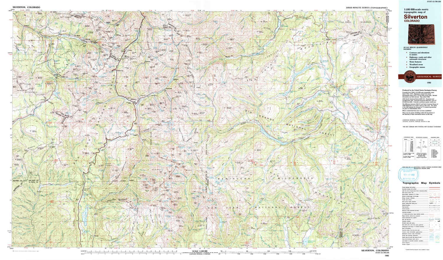
USGS topographic map of Silverton, CO, at 1:100000 scale. Lighter material. Waterproof. Tear-resistant. Foldable. Very durable. Perfect for backpacking and the outdoors.
Cities, towns, villages: Liberty Bell,Pandora,Ilium,San Miguel,Sneffels (historical),Logtown (historical),Middleton,Mountain Village,Gladstone (historical),Ironton,Alta (historical),Lime,Tacoma,Thistledown,Vance Junction,Guston (historical),Silverton,Eureka,Animas Forks (historical),Ophir Loop,Beartown (historical),Camp Bird,Cascade,Needleton,Telluride,Ames,Chattanooga (historical),Vanadium,Keystone,Ophir,Howardsville,Tomboy (historical)
Mountains: Grenadier Range,Needle Mountains,West Needle Mou,River Hill,Gravel Mountain,Animas Mountain,White Dome,Gray Needle,Needle Mountains Peak Seven,Needle Mountains Peak Four,Buffalo Peak,Stag Mesa,Needle Mountains Peak Eleven,Snow Mesa,Lime Mesa
Valleys: Tiger Gulch,Poughkeepsie Gulch,South Hole,Minnesota Gulch,Waterhole Slide,South Canyon,McIntyre Gulch,Albany Gulch,Starvation Gulch,Commodore Gulch,Boulder Gulch,Swamp Canyon,Brooklyn Gulch
Buy products not available in the Philippines.


