Galleon 2026Download our mobile shopping application for faster and easy transaction.
Product ID:
134113
Identifier:
156695830X
Brand:
National Geographic
Model:
Shipping Weight:
0.21 lbs
Manufacturer:
National Geographic Maps
Shipping Dimension:
9.21 x 4.29 x 0.35 inches
₱1,434
+ ₱ 150
Shipping Cost from USA to Philippines inclusive of custom fees.
Cost too high? Check weight and dimension on product details and click "I think this is wrong?" link.
Get it between 2026-06-04 to 2026-06-11.
Additional 3 business days for provincial shipping.
- Price and Stocks may change without prior notice
- Packaging of actual item may differ from photo shown
Cash upon Pick-up - orders grand total must not exceed ₱5,000.00. Order will be pickup at Galleon's Office.
Cash on Delivery - orders grand total must not exceed of ₱10,000.00 and must not exceed ₱5,000.00 for provincial areas. See all payment methods
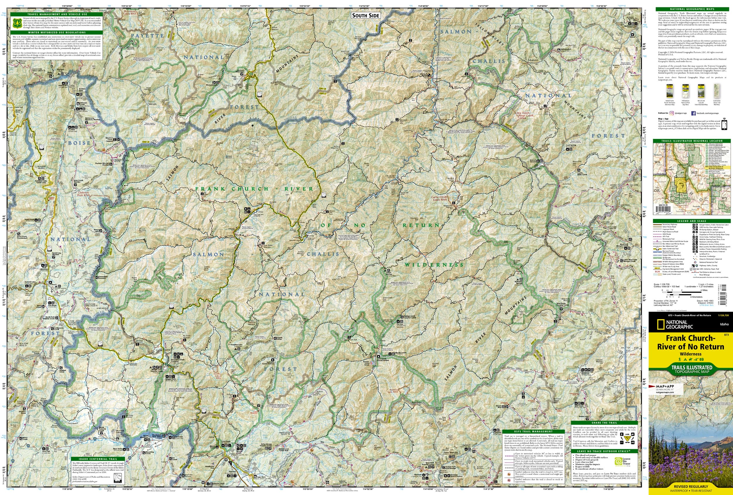
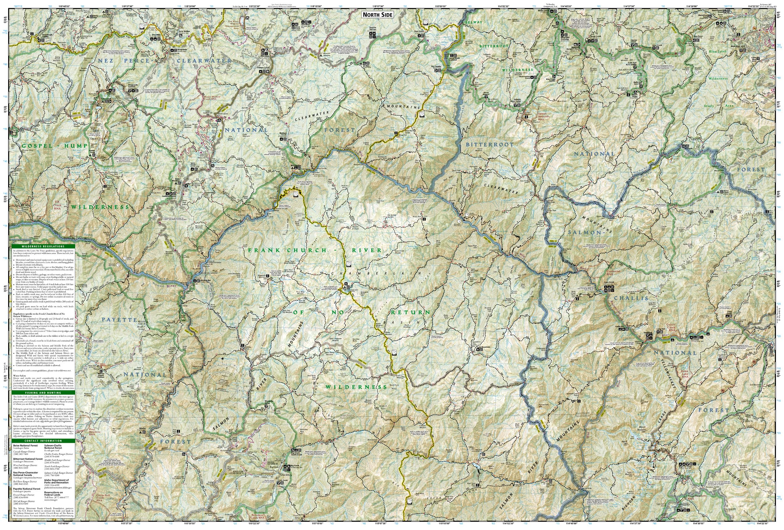
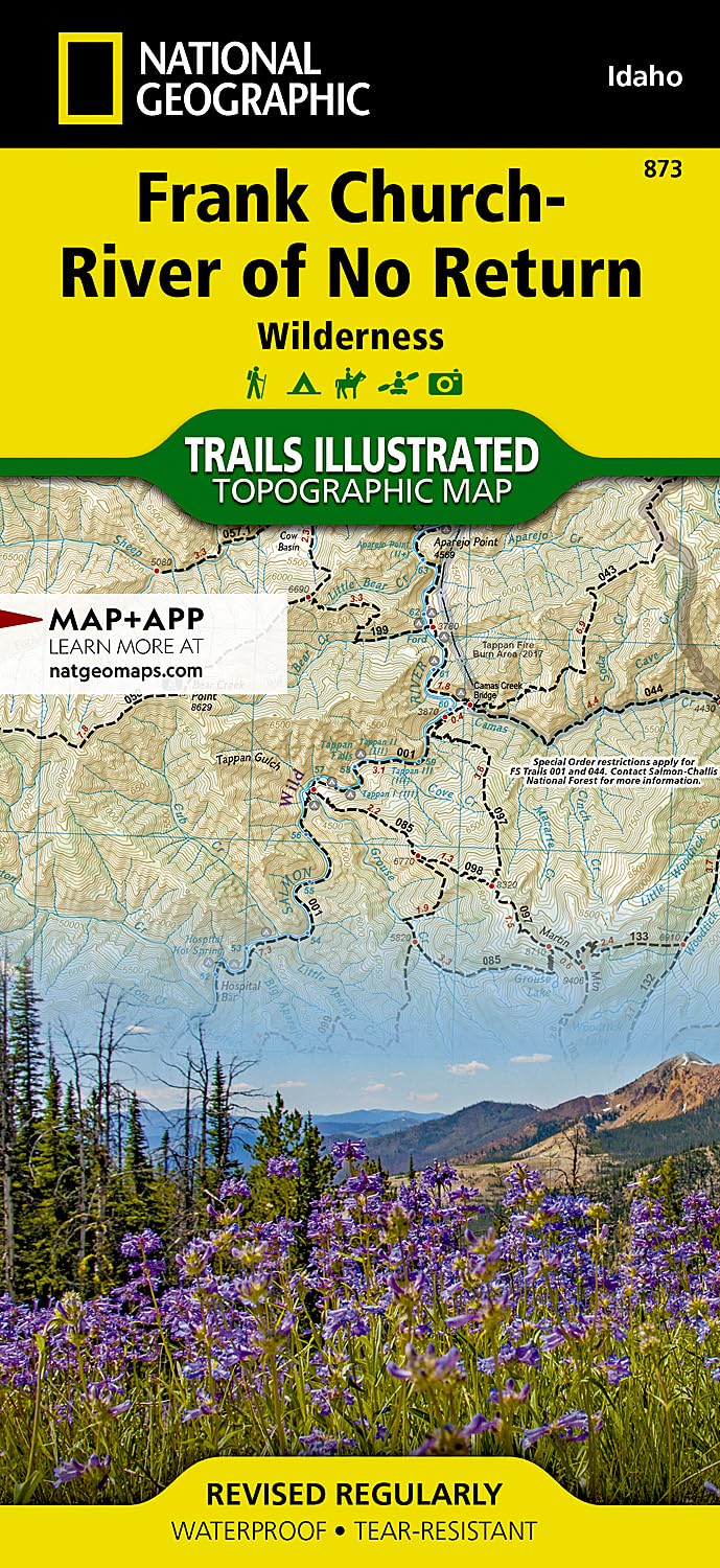
• Waterproof • Tear-Resistant • Topographic Map National Geographic's Trails Illustrated map of the Frank Church-River of No Return Wilderness maps the largest contiguous wilderness in the Lower 48 in its entirety. The area is filled with steep, rugged mountains, deep canyons, and wild, whitewater rivers. The Salmon River Canyon runs through the northern edge of the wilderness and is one of the deepest gorges in North America, deeper even than the Grand Canyon. "The River of No Return" name comes from the early days when boats could navigate down the river, but could not get back up through the fast water and numerous rapids. The map includes both non-motorized and motorized trails, snowmobile routes, Idaho's Game Management Units, backcountry facilities and landing strips, lookout towers, whitewater access sites, river camps, and milemarkers along major rivers. A large stretch of the Idaho Centennial Trail runs through the center of the map. Every Trails Illustrated map is printed on "Backcountry Tough" waterproof, tear-resistant paper. A full UTM grid is printed on the map to aid with GPS navigation. Every map purchase helps support the National Geographic Society, an impact driven, nonprofit organization with global reach that uses the power of science, exploration, education, and storytelling to illuminate and protect the wonder of our world. Other features found on this map include: Beartrap Ridge, Bighorn Crags, Bitterroot National Forest, Blue Joint Wilderness Study Area, Boise National Forest, Burgdorf Summit, Clearwater Mountains, Custer Town Site and Motorway, Magruder Corridor Road, Middle Fork Salmon River, Mount McGuire, Nez Perce-Clearwater National Forest, Panther Creek, Payette National Forest, Red River Ranger Station, Salmon-Challis National Forest, South Fork Salmon River, Yellowjacket Mountains. Map Scale = 1:126,720 Sheet Size = 25.5" x 37.75" Folded Size = 4.25" x 9.25"
Buy products not available in the Philippines.