Galleon 2026Download our mobile shopping application for faster and easy transaction.
Product ID:
420279
Identifier:
1566952999
Brand:
National Geographic
Model:
NatGeo Maps: Trails Illustrated
Shipping Weight:
0.2 lbs
Manufacturer:
National Geographic Maps
Shipping Dimension:
9.13 x 4.25 x 0.24 inches
₱1,434
₱973
+ ₱ 150
Shipping Cost from USA to Philippines inclusive of custom fees.
Cost too high? Check weight and dimension on product details and click "I think this is wrong?" link.
Get it between 2026-06-06 to 2026-06-13.
Additional 3 business days for provincial shipping.
- Price and Stocks may change without prior notice
- Packaging of actual item may differ from photo shown
Cash upon Pick-up - orders grand total must not exceed ₱5,000.00. Order will be pickup at Galleon's Office.
Cash on Delivery - orders grand total must not exceed of ₱10,000.00 and must not exceed ₱5,000.00 for provincial areas. See all payment methods
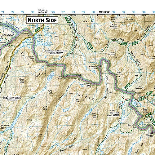
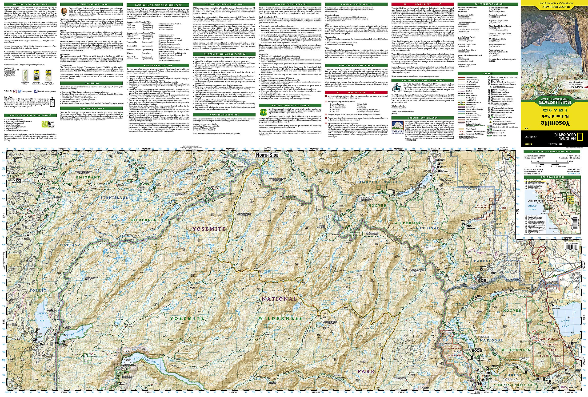
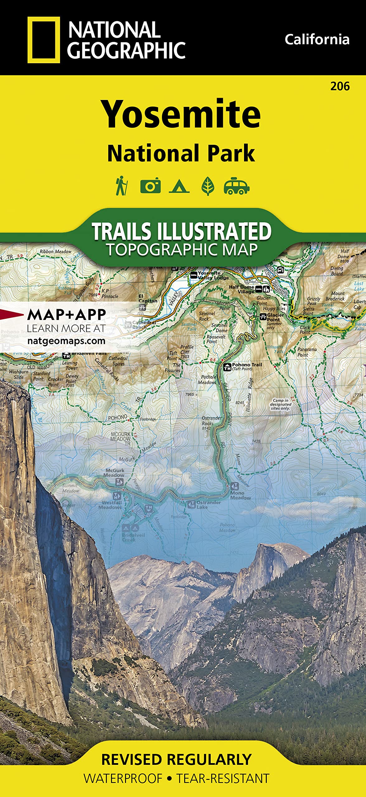
National Geographic Yosemite Natl Park #206 by California - TI00000206
• Waterproof • Tear-Resistant • Topographic Map Explore the majesty of Yosemite National Park with National Geographic's Trails Illustrated map. Loaded with helpful information on camping, hiking, lodging, transportation, regulations, and safety, this map is an invaluable tool for casual park visitors and avid adventurers alike. Expertly researched and created in partnership with local land management agencies, the map features key areas of interest including Stanislaus National Forest, Emigrant Wilderness, Carson Iceberg Wilderness, Toiyabe National Forest, Hoover Wilderness, Inyo National Forest, Yosemite Wilderness, Sierra National Forest, and Ansel Adams Wilderness. Detail of the popular Tuolumne Meadows and Yosemite Valley are provided in inset maps. With almost 800 miles of mapped trails, the Yosemite National Park map can guide you off the beaten path and back again. The clearly marked trails include mileages between intersections. The map base includes contour lines and elevations for summits, passes and major lakes. Some of the many recreation features include: campgrounds, trailheads, tram tours, ski areas, river access, scenic overlooks, scenic byways, and interpretive trails. Every Trails Illustrated map is printed on "Backcountry Tough" waterproof, tear-resistant paper. A full UTM grid is printed on the map to aid with GPS navigation. Other features found on this map include: Ansel Adams Wilderness, Bridalveil Fall, Cathedral Range, El Capitan, Emigrant Wilderness, Excelsior Mountain, Hoover Wilderness, Illilouette Falls, Inyo National Forest, Lake Eleanor, Lower Yosemite Fall, Matterhorn Peak, Mount Dana, Mount Lyell, Mount Ritter, Nevada Fall, Ribbon Fall, Ritter Range, Sierra National Forest, Silver Strand Falls, Stanislaus National Forest, Tioga Pass, Toiyabe National Forest, Upper Yosemite Falls, Vernal Fall, Yosemite National Park, Yosemite Valley. Map Scale = 1:80,000 & 1:40,000 Sheet Size = 37.75" x 25.5" Folded Size = 4.25" x 9.25"
Buy products not available in the Philippines.