Galleon 2026Download our mobile shopping application for faster and easy transaction.
Product ID:
1870217
Identifier:
1566953073
Brand:
National Geographic
Model:
Shipping Weight:
0.2 lbs
Manufacturer:
Natl Geographic Society Maps
Shipping Dimension:
9.57 x 4.76 x 1.18 inches
₱1,480
+ ₱ 252
Shipping Cost from USA to Philippines inclusive of custom fees.
Cost too high? Check weight and dimension on product details and click "I think this is wrong?" link.
Get it between 2026-06-18 to 2026-06-25.
Additional 3 business days for provincial shipping.
- Price and Stocks may change without prior notice
- Packaging of actual item may differ from photo shown
Cash upon Pick-up - orders grand total must not exceed ₱5,000.00. Order will be pickup at Galleon's Office.
Cash on Delivery - orders grand total must not exceed of ₱10,000.00 and must not exceed ₱5,000.00 for provincial areas. See all payment methods
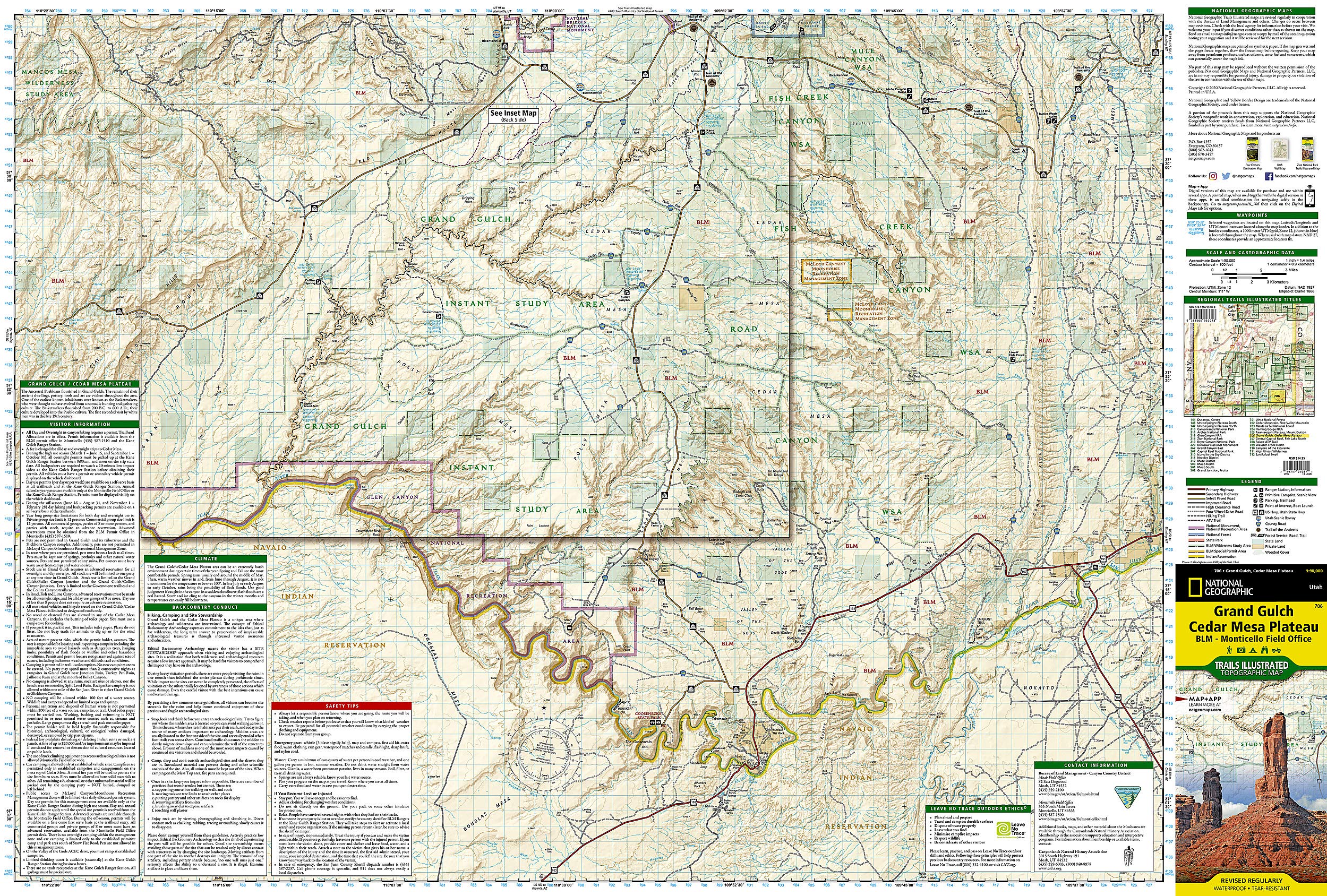
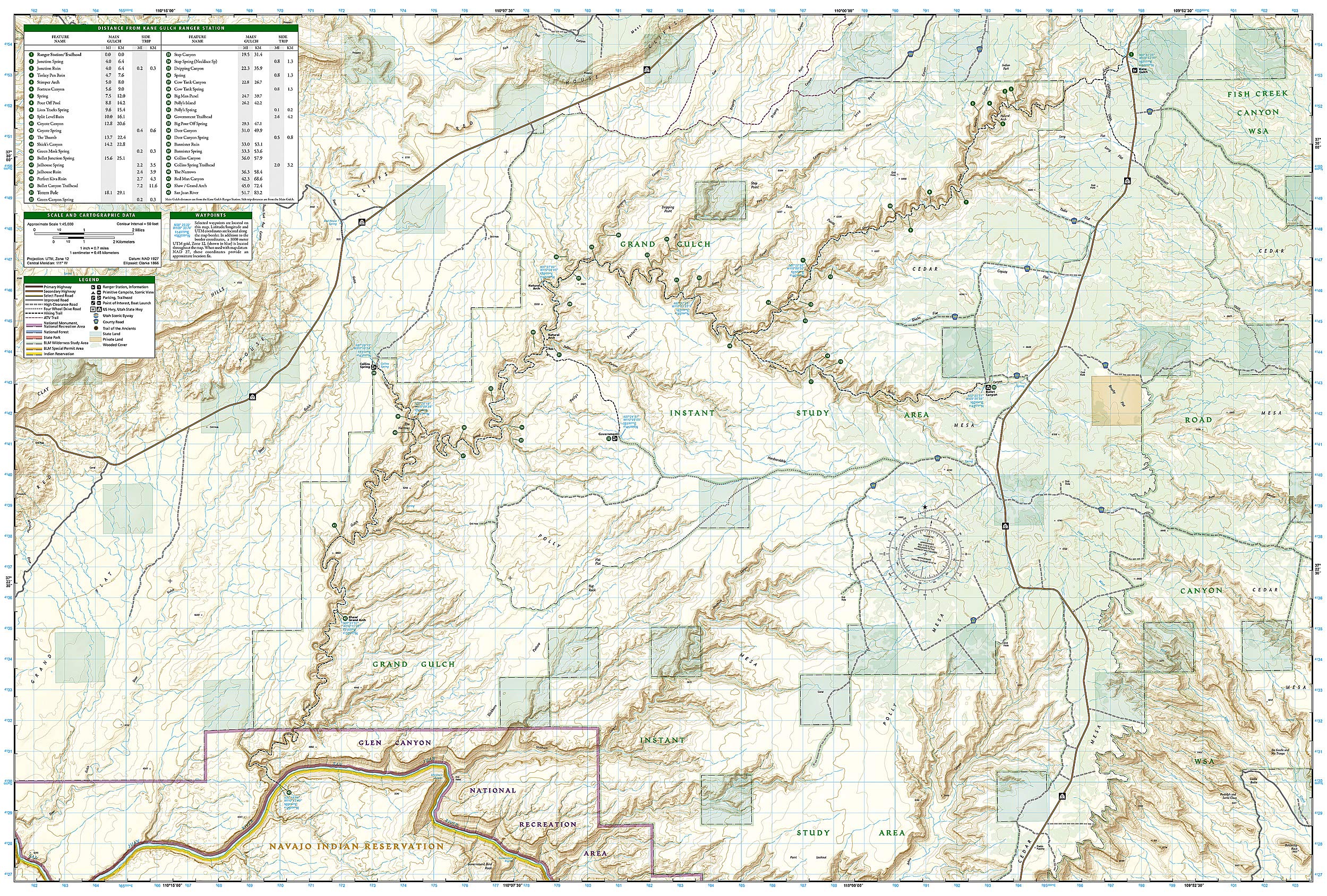
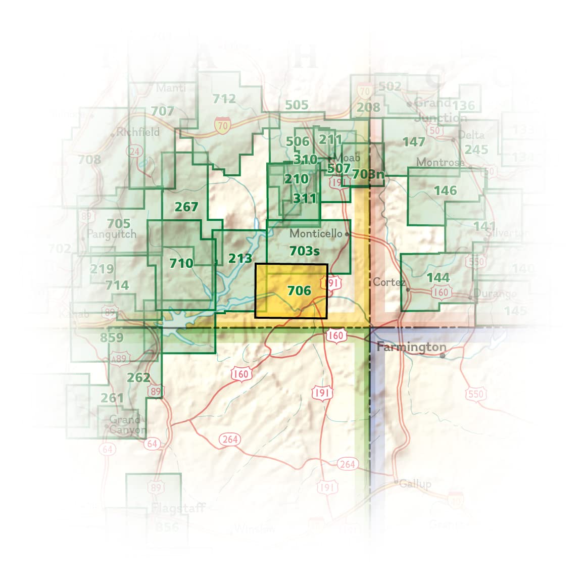
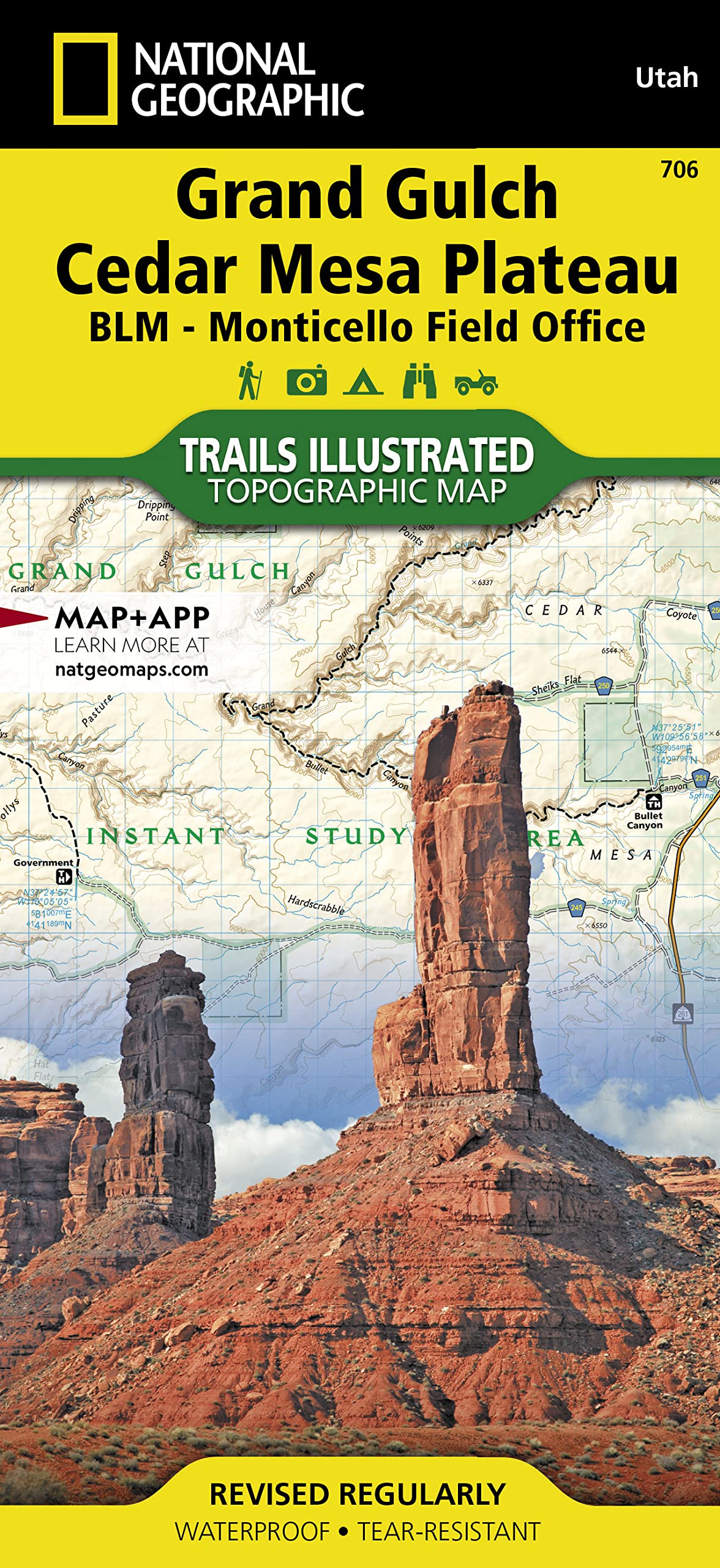
• Waterproof • Tear-Resistant • Topographic Map Grand Gulch is a truly unique, rugged, remote, historic area. National Geographic's Trails Illustrated map of Grand Gulch and the Cedar Mesa Plateau was created in partnership with the Bureau of Land Management to provide unmatched detail and and useful information to help you get the most from your visit. The map includes areas around Grand Gulch, including: Fish Creek, Road and Mule Canyons WSA and Glen Canyon National Recreation Area. The print map includes an inset map of Grand Gulch Instant Study Area with special detail of the trail from the Kane Gulch Ranger Station down to the San Juan River. The map includes a table of this 51.7 mile trail, with 43 features and points of interest along the way, including their mileage from the ranger station. The map contains miles of side trails to such places as Government, Bullet Canyon and Collins Spring. In addition to all of this, to help navigate the area, the map has GPS coordinates, contour lines and elevations throughout the trail. Other points of interest that are noted on the map include campsites, scenic views, boat launch locations, trailheads and much more. Visitor information, safety tips and contact information are also included to ensure a safe and enjoyable adventure. Every Trails Illustrated map is printed on "Backcountry Tough" waterproof, tear-resistant paper. A full UTM grid is printed on the map to aid with GPS navigation. Other features found on this map include: Chinle Creek, Comb Ridge, Glen Canyon National Recreation Area, Grand Gulch Plateau, Monument Valley, Red House Cliffs, Valley of the Gods. Map Scale = 1:45,000 & 1:90,000 Sheet Size = 37.75" x 25.5" Folded Size = 4.25" x 9.25"
Buy products not available in the Philippines.