Galleon 2026Download our mobile shopping application for faster and easy transaction.
Product ID:
847359
Identifier:
1566958083
Brand:
National Geographic
Model:
Shipping Weight:
0.2 lbs
Manufacturer:
National Geographic Maps
Shipping Dimension:
9.29 x 4.25 x 0.28 inches
₱1,434
₱1,341
+ ₱ 150
Shipping Cost from USA to Philippines inclusive of custom fees.
Cost too high? Check weight and dimension on product details and click "I think this is wrong?" link.
Get it between 2026-06-04 to 2026-06-11.
Additional 3 business days for provincial shipping.
- Price and Stocks may change without prior notice
- Packaging of actual item may differ from photo shown
Cash upon Pick-up - orders grand total must not exceed ₱5,000.00. Order will be pickup at Galleon's Office.
Cash on Delivery - orders grand total must not exceed of ₱10,000.00 and must not exceed ₱5,000.00 for provincial areas. See all payment methods
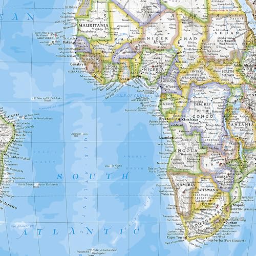
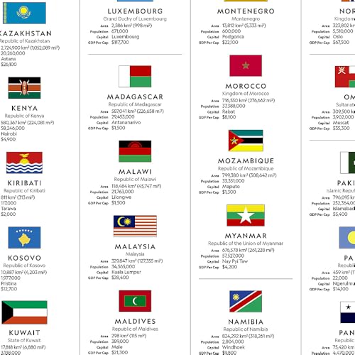
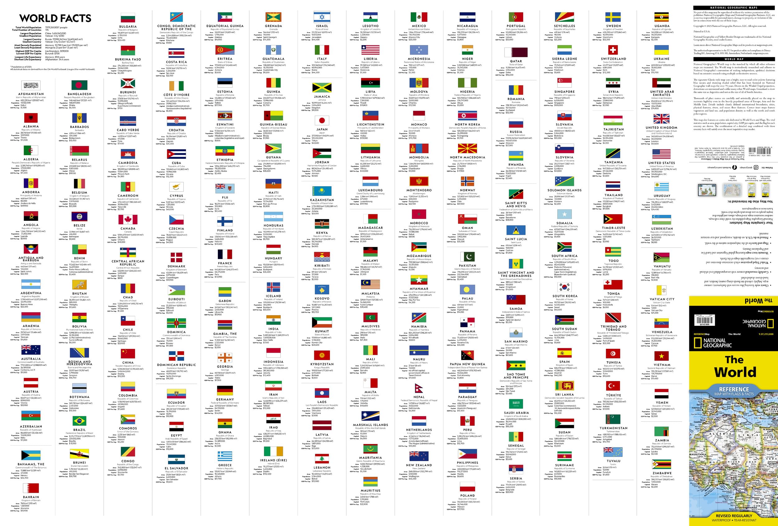
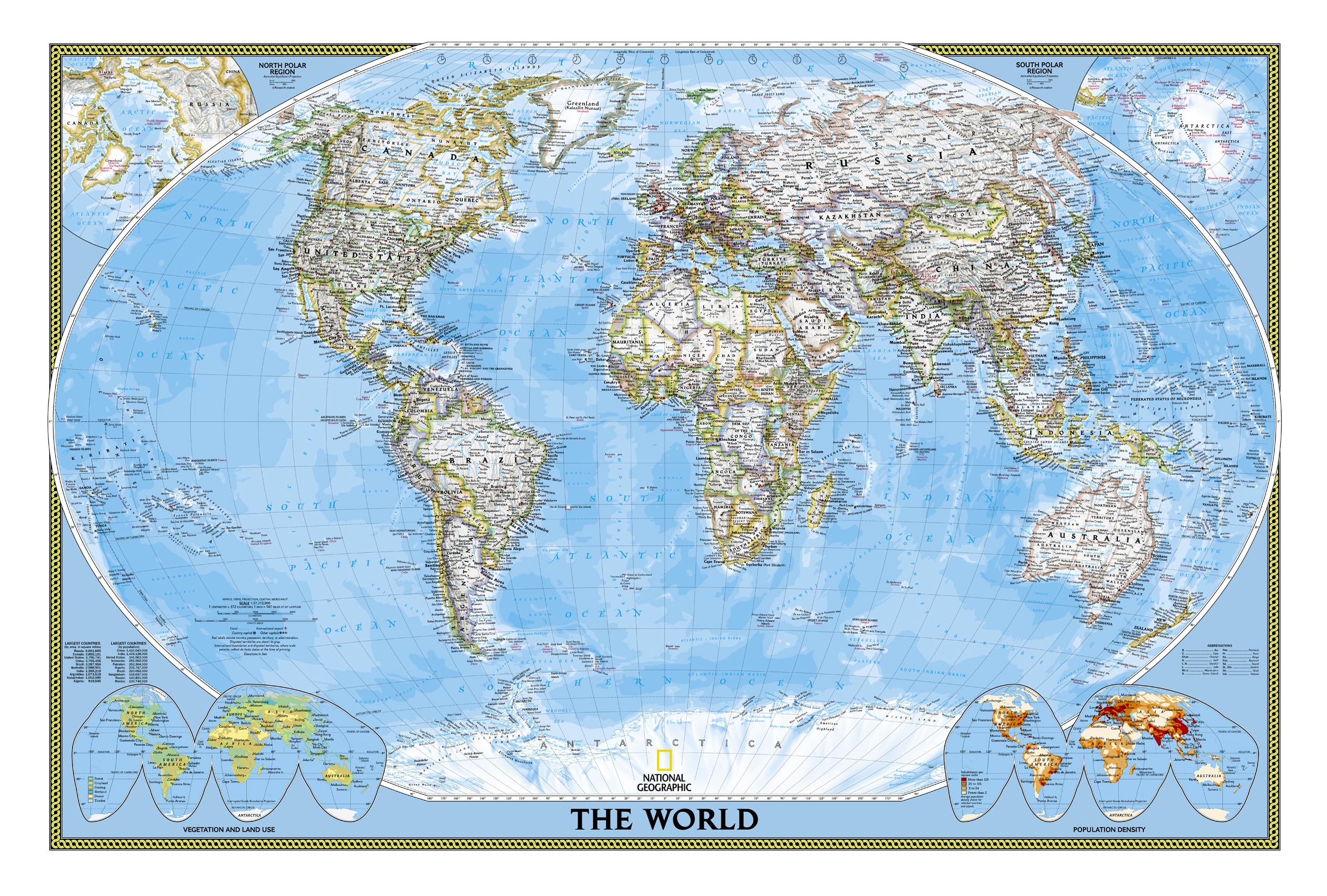
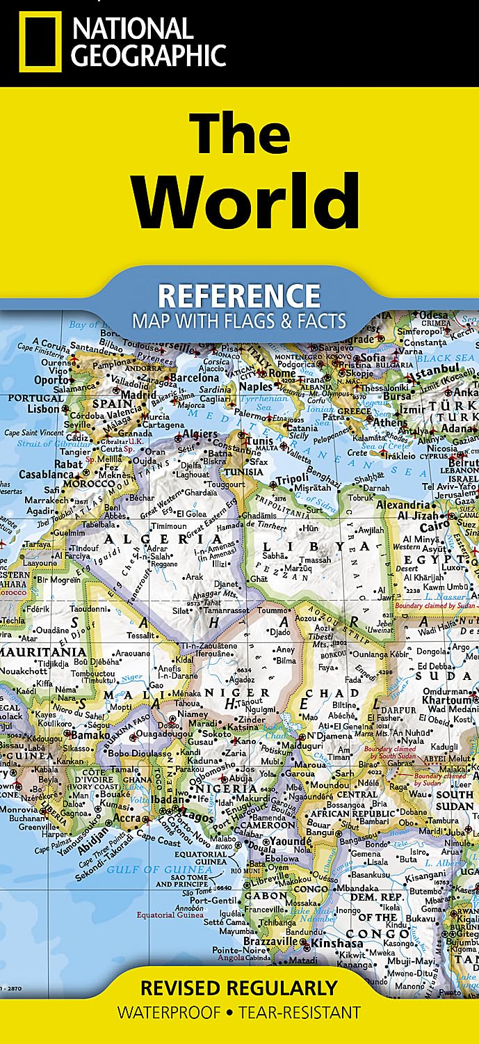
Expertly researched and designed, National Geographic's World with Flags & Facts Map is the authoritative map of the world by which other reference maps are measured. The folded world map is designed for travel and durability. Product Features: Signature Classic style map with bright, easy to read color palette with blue oceans and colorful borders Background shows mountain ranges and valleys in subtle shaded relief with mountain ranges labeled Major water bodies including rivers, lakes, glaciers, oceans, seas, gulfs, bays, straits, and bathymetry Clearly defined international boundaries, cities, islands, airports, and physical features Thousands of place names carefully and artfully placed to maintain legibility in heavily populated areas Up-to-date international boundaries and territorial control reflect de facto status on the ground Meticulously researched using multiple authoritative sources including the U.N., U.S. Board on Geographic Names, and policies of individual governments. Accurate place names use a combination of conventional English names, official national names, and standard transliterations for non-Latin alphabets. Drawn in Winkel Tripel projection with distortions minimized unlike other World maps (e.g. Greenland is shown the same size as Argentina, not South America) Corner inset maps feature vegetation, land use, population density, and north and south polar regions National facts and flags with each country's area, population, capital city, GDP per capita, and flag The map is printed in the USA on durable waterproof, tear-resistant synthetic paper to withstand repeated folding. Map Scale = 1:37,213,000 Sheet Size = 37.75" x 25.5" Folded Size = 4.25" x 9.25"
Buy products not available in the Philippines.