Galleon 2026Download our mobile shopping application for faster and easy transaction.
Product ID:
186405
Identifier:
1566954959
Brand:
National Geographic
Model:
NAGGR167
Shipping Weight:
0.2 lbs
Manufacturer:
National Geographic Maps
Shipping Dimension:
9.21 x 4.29 x 0.31 inches
₱1,434
₱1,174
+ ₱ 150
Shipping Cost from USA to Philippines inclusive of custom fees.
Cost too high? Check weight and dimension on product details and click "I think this is wrong?" link.
Get it between 2026-06-02 to 2026-06-09.
Additional 3 business days for provincial shipping.
- Price and Stocks may change without prior notice
- Packaging of actual item may differ from photo shown
Cash upon Pick-up - orders grand total must not exceed ₱5,000.00. Order will be pickup at Galleon's Office.
Cash on Delivery - orders grand total must not exceed of ₱10,000.00 and must not exceed ₱5,000.00 for provincial areas. See all payment methods
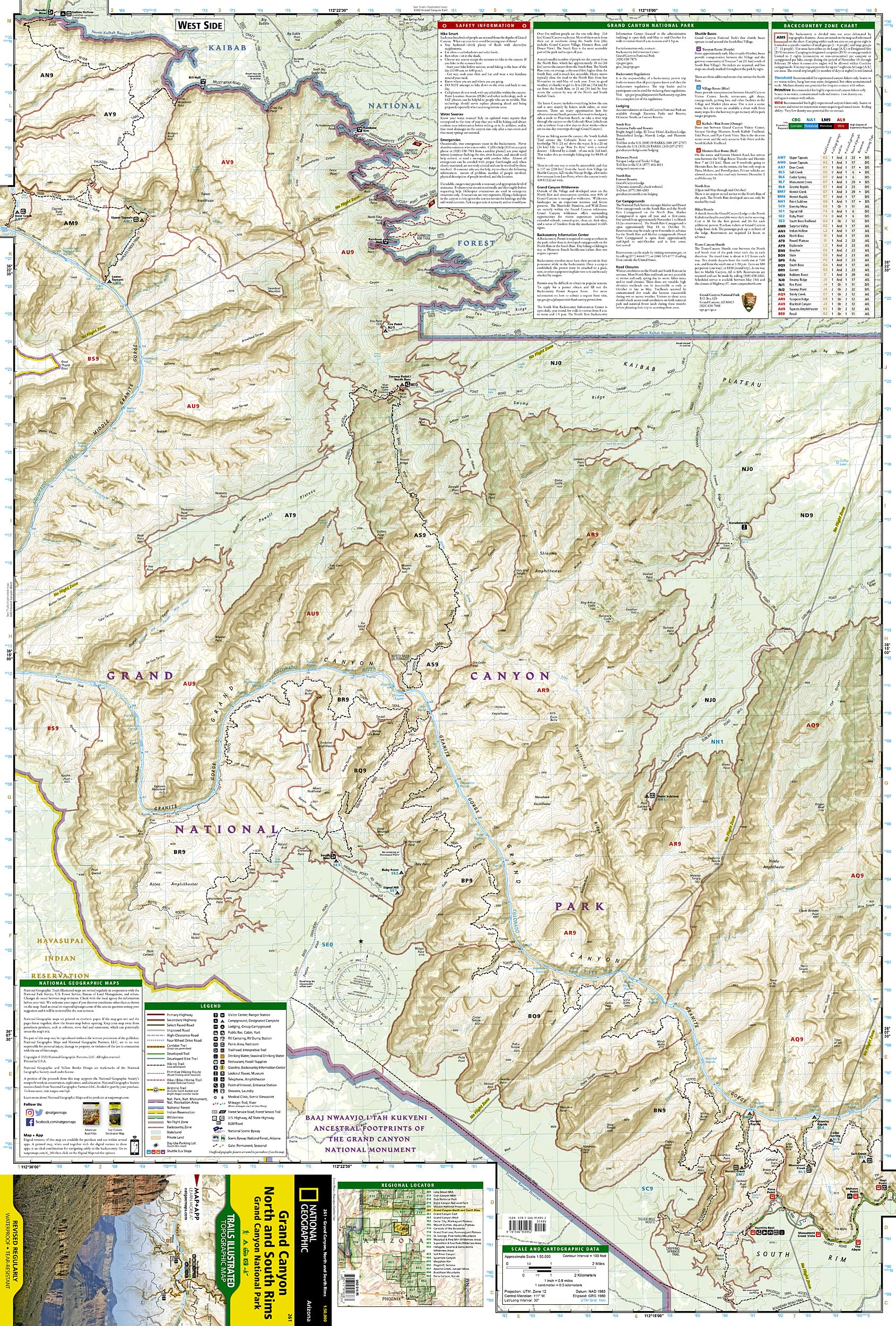
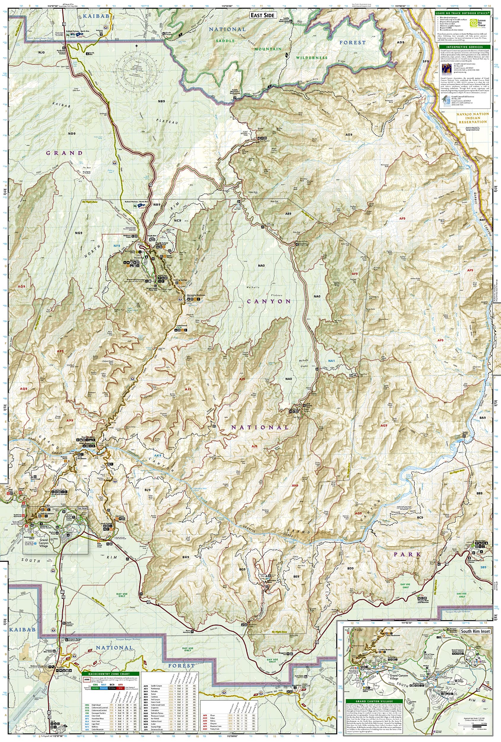
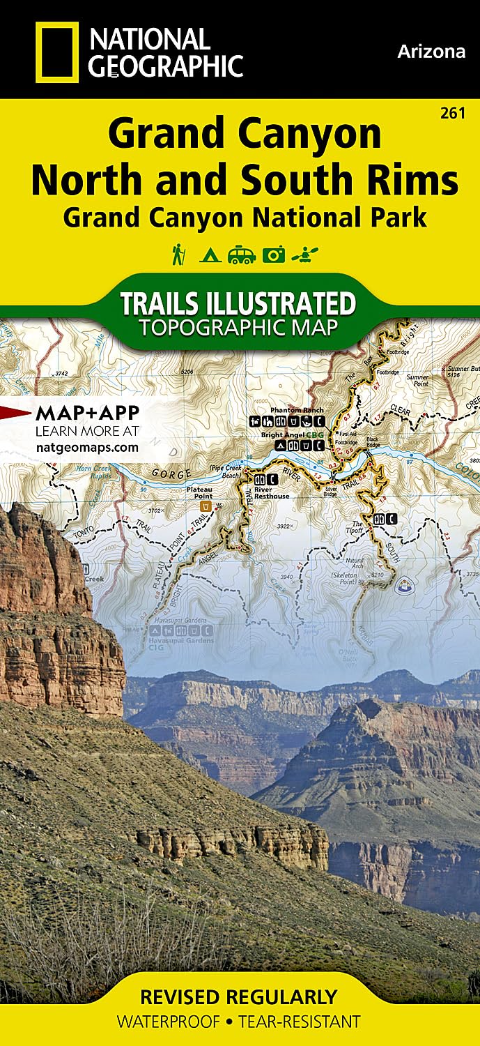
Trails Illustrated Map: Grand Canyon National Park
Trails Illustrated Map: Grand Canyon National Park
National Geographic Maps
• Waterproof • Tear-Resistant • Topographic Map Explore the uniquely inspiring and wondrous landscape of the Grand Canyon with National Geographic's Trails Illustrated map of Grand Canyon National Park, North and South Rims. Expertly researched and created in partnership with local land management agencies, this map is designed to meet the needs of outdoor enthusiasts with unmatched detail of the heart of the park. Key areas of interest featured on this map include Colorado River miles 60-98, North and South Rim visitor centers, Grand Canyon Village, Tusayan, Bright Angel Trail (plus elevation profile), West Rim Trail, Kaibab Trail, Arizona Trail, and more. With miles of mapped trails in some of the most breathtaking scenery in the entire country, the Grand Canyon North and South Rims map can guide you off the beaten path and back again. Designed with a wide range of visitors in mind, this map features detailed and easy to read trails, accurate road network, campgrounds, scenic overlooks and points of interests, visitor centers and facilities, color coded bus stops with routes, plus park regulations, backcountry use areas, and contact information for local agencies. The map base includes contour lines and elevations for summits, passes and major lakes. Every Trails Illustrated map is printed on "Backcountry Tough" waterproof, tear-resistant paper. A full UTM grid is printed on the map to aid with GPS navigation. Other features found on this map include: Grand Canyon National Park, Kaibab National Forest, Little Colorado River, Marble Canyon. Map Scale = 1:50,000 Sheet Size = 25.5" x 37.75" Folded Size = 4.25" x 9.25"
Buy products not available in the Philippines.