Galleon 2026Download our mobile shopping application for faster and easy transaction.
Product ID:
676354
Identifier:
1566955041
Brand:
National Geographic
Model:
Shipping Weight:
0.2 lbs
Manufacturer:
Natl Geographic Society Maps
Shipping Dimension:
9.21 x 4.21 x 0.31 inches
₱1,434
+ ₱ 150
Shipping Cost from USA to Philippines inclusive of custom fees.
Cost too high? Check weight and dimension on product details and click "I think this is wrong?" link.
Get it between 2026-06-17 to 2026-06-24.
Additional 3 business days for provincial shipping.
- Price and Stocks may change without prior notice
- Packaging of actual item may differ from photo shown
Cash upon Pick-up - orders grand total must not exceed ₱5,000.00. Order will be pickup at Galleon's Office.
Cash on Delivery - orders grand total must not exceed of ₱10,000.00 and must not exceed ₱5,000.00 for provincial areas. See all payment methods
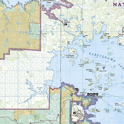
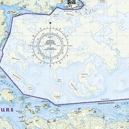
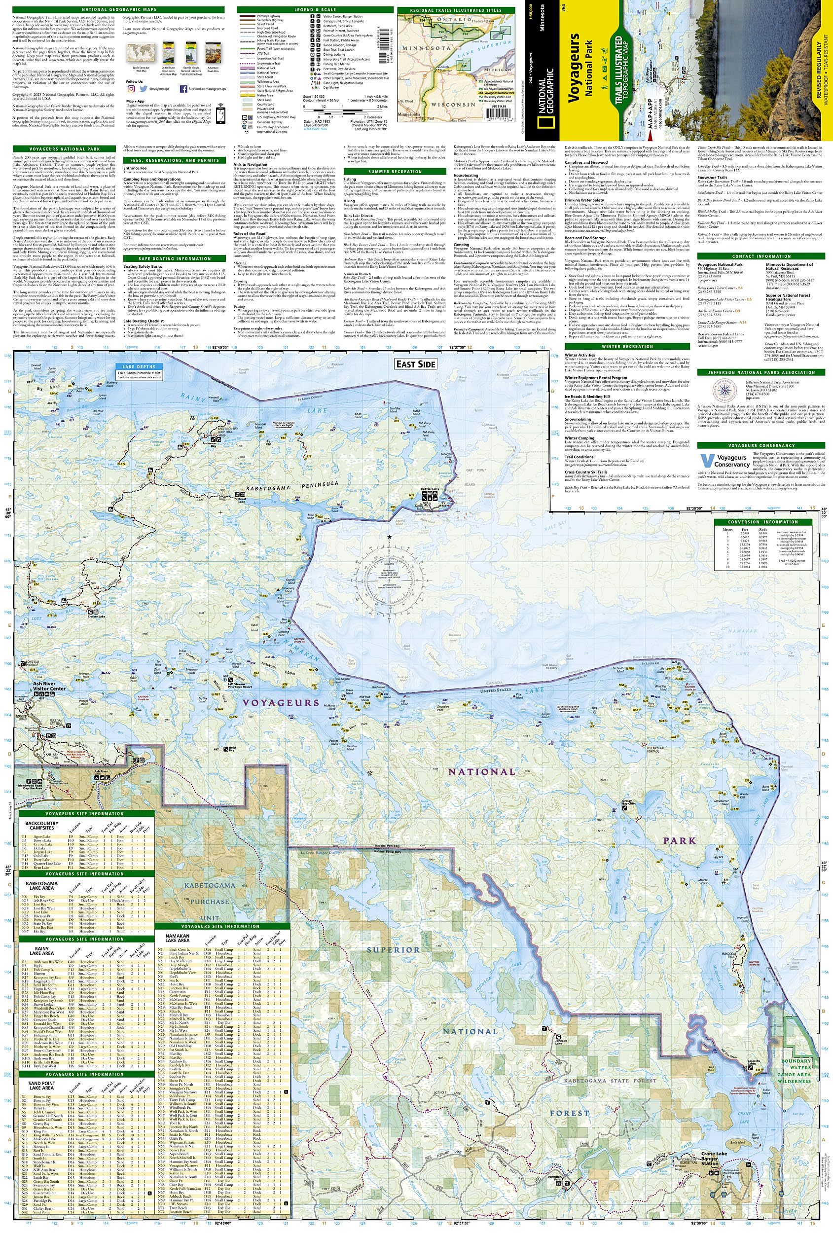
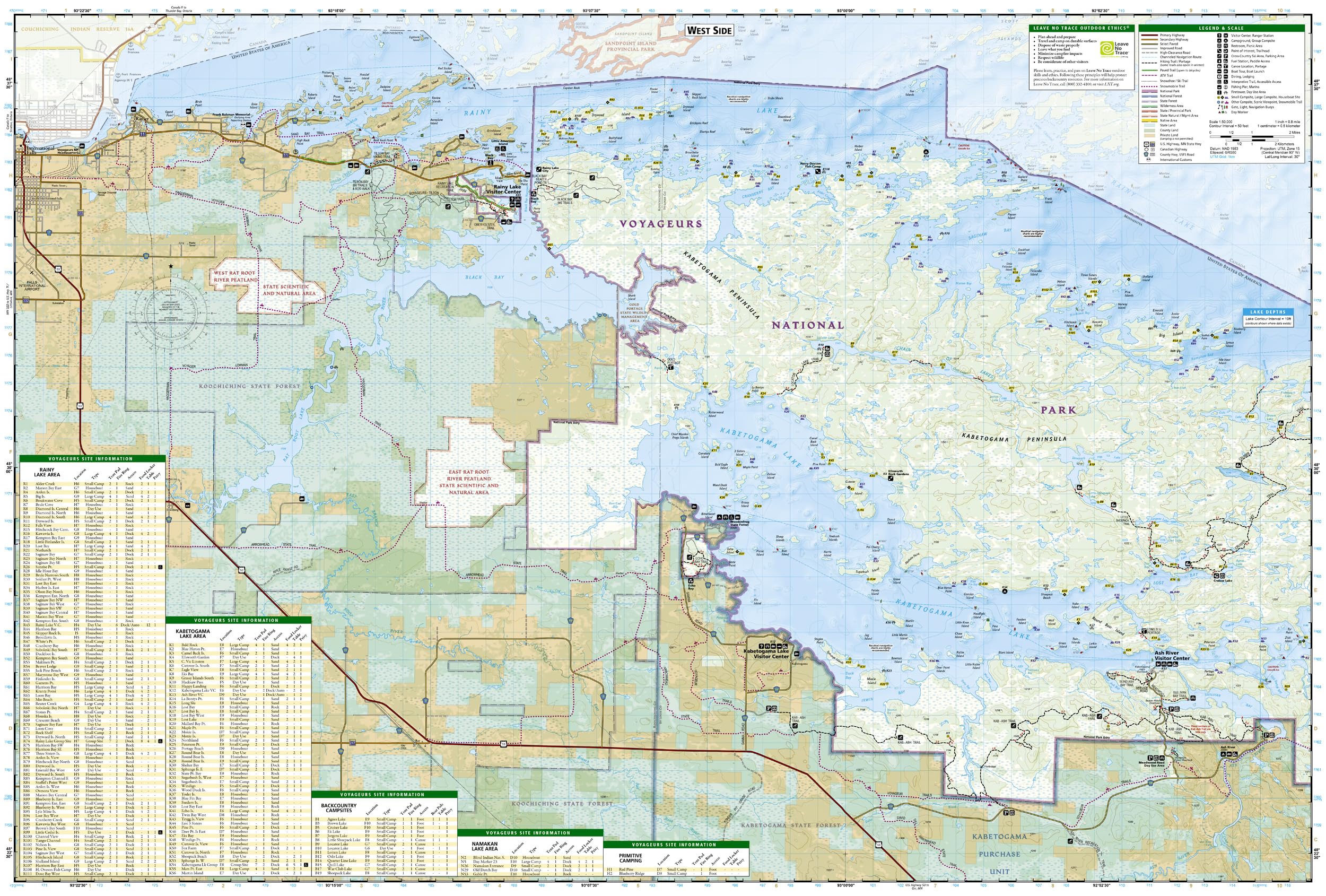
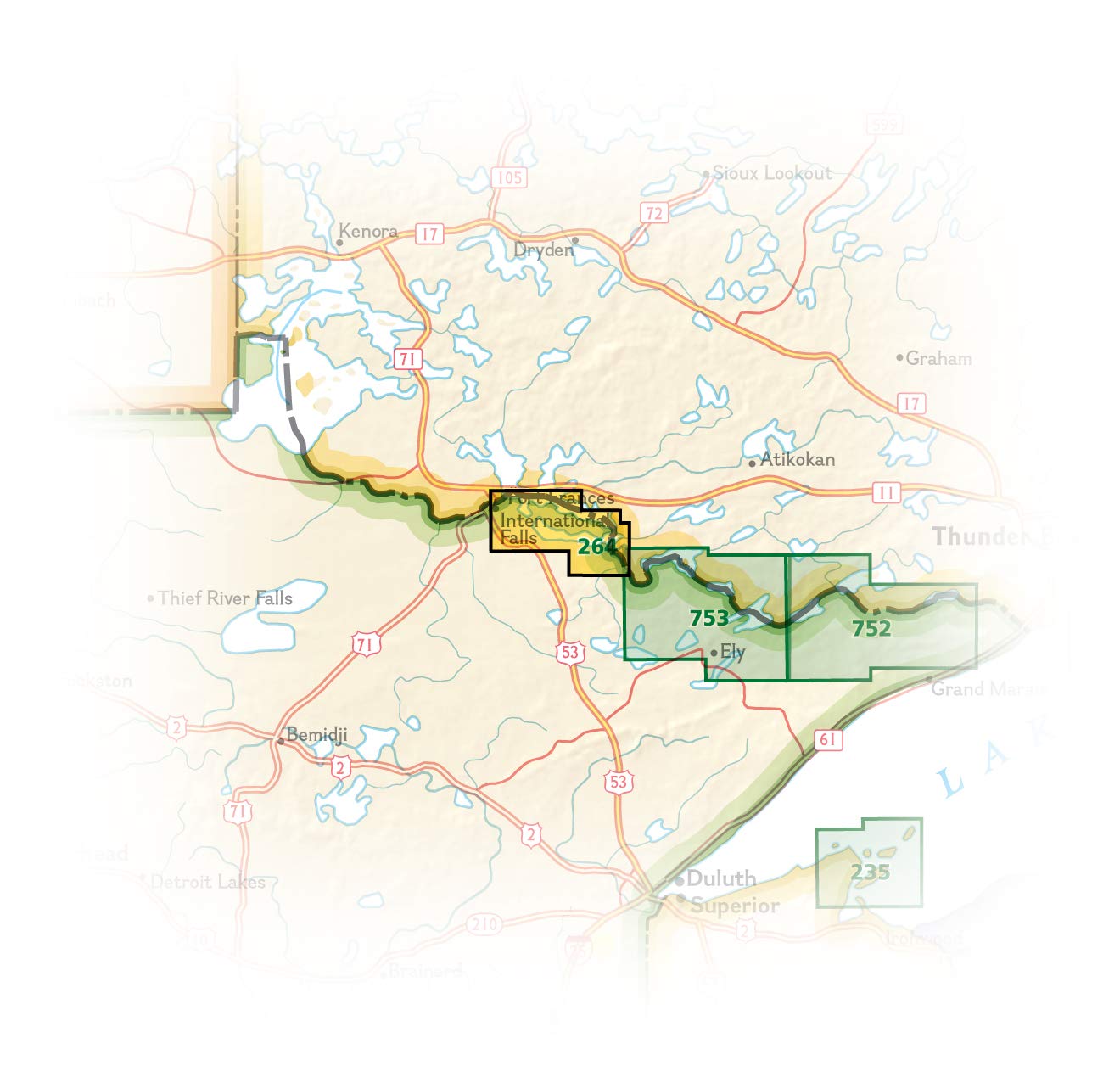
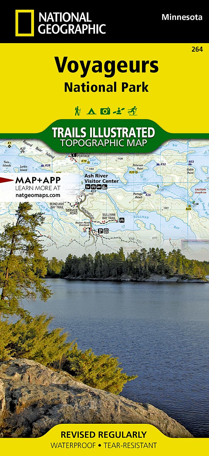
VOYAGEURS NATIONAL PARK #264
• Waterproof • Tear-Resistant • Topographic Map Located at the border of Minnesota and Canada, Voyageurs National Park is defined by its interconnected waterways which require you to leave your car behind and explore by kayak, canoe, houseboat, or motorboat. In winter, snowmobiles, snowshoes, and skis will be your mode of travel in this extraordinary wilderness. National Geographic's Trails Illustrated map of Voyageurs National Park combines unmatched detail with helpful information to offer an invaluable tool for making the most of your visit to this inspiring region. Expertly researched and created in partnership with local land management agencies, this map features key park attractions including Gull Island Rookery; Grassy Bay Cliffs; Anderson Bay; Kettle Falls; Hoist Bay; Gold Portage; and the Ash River, Kabetogama Lake, and Rainy Lake Visitor Centers. Designed with a wide range of visitors in mind, this map features detailed and easy-to-read trails, accurate road network, visitor centers and facilities, safety tips, recreation opportunities, plus information on park fees, reservations, and permits. An extensive chart of campsites will help you choose a location that's right for you. Snowmobile and snowshoe trails are clearly noted for those enjoying winter recreation in the park. Many other recreation features are noted as well, including trailheads, boat launches, paddle access, houseboat sites, cross-country ski areas, interpretive trails, and points of interest. The map base includes contour lines and elevations for both land and waterways. Every Trails Illustrated map is printed on "Backcountry Tough" waterproof, tear-resistant paper. A full UTM grid is printed on the map to aid with GPS navigation. Other features found on this map include: Black Bay, Kabetogama Lake, Namakan Lake, Rainy Lake, Superior National Forest, Voyageurs National Park. Map Scale = 1:50,000 Sheet Size = 25.5" x 37.75" Folded Size = 4.25" x 9.25"
Buy products not available in the Philippines.