Galleon 2026Download our mobile shopping application for faster and easy transaction.
Product ID:
207016
Identifier:
1566958253
Brand:
National Geographic
Model:
Shipping Weight:
0.2 lbs
Manufacturer:
National Geographic Maps
Shipping Dimension:
9.13 x 4.25 x 0.35 inches
₱1,434
+ ₱ 150
Shipping Cost from USA to Philippines inclusive of custom fees.
Cost too high? Check weight and dimension on product details and click "I think this is wrong?" link.
Get it between 2026-06-04 to 2026-06-11.
Additional 3 business days for provincial shipping.
- Price and Stocks may change without prior notice
- Packaging of actual item may differ from photo shown
Cash upon Pick-up - orders grand total must not exceed ₱5,000.00. Order will be pickup at Galleon's Office.
Cash on Delivery - orders grand total must not exceed of ₱10,000.00 and must not exceed ₱5,000.00 for provincial areas. See all payment methods
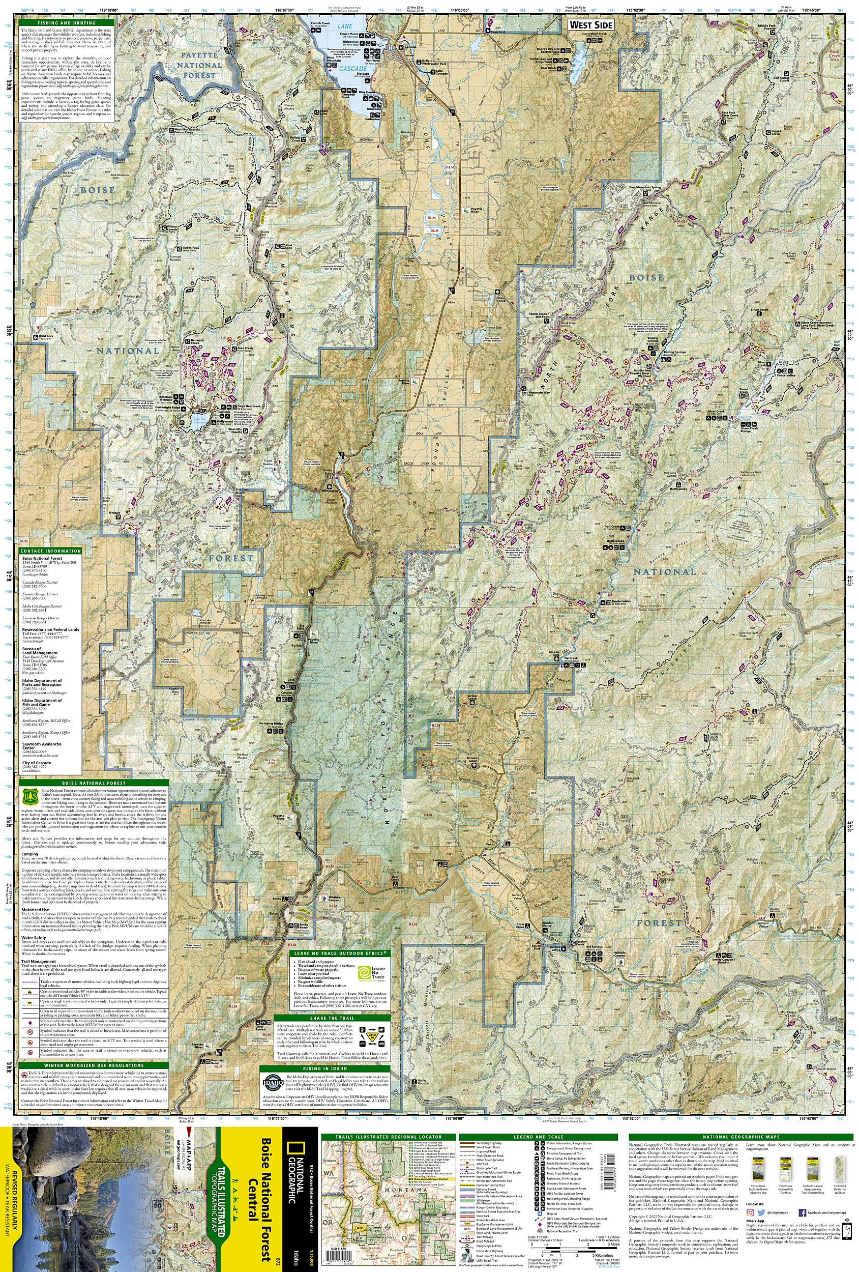
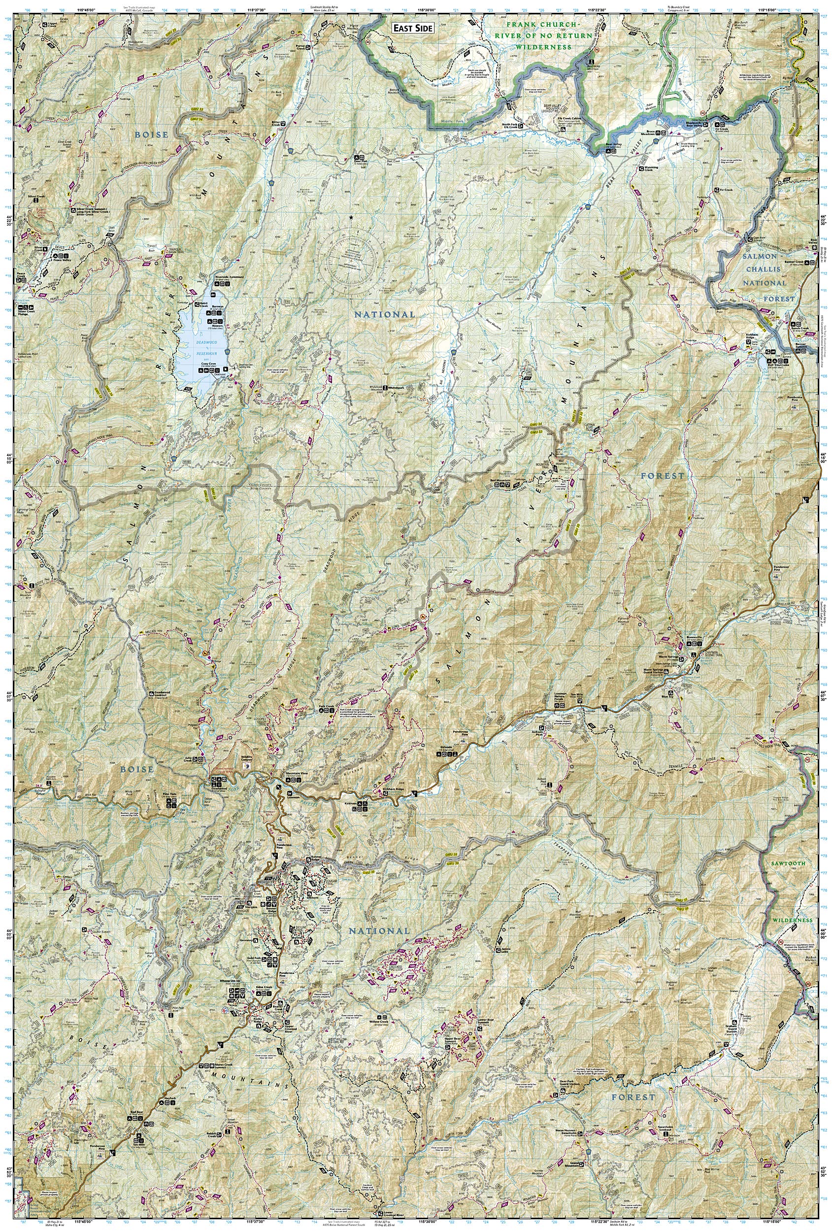
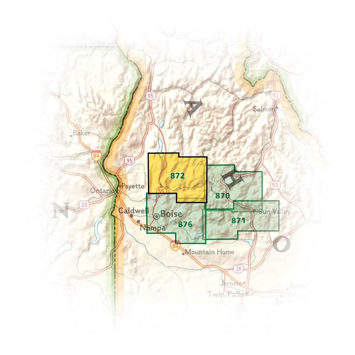
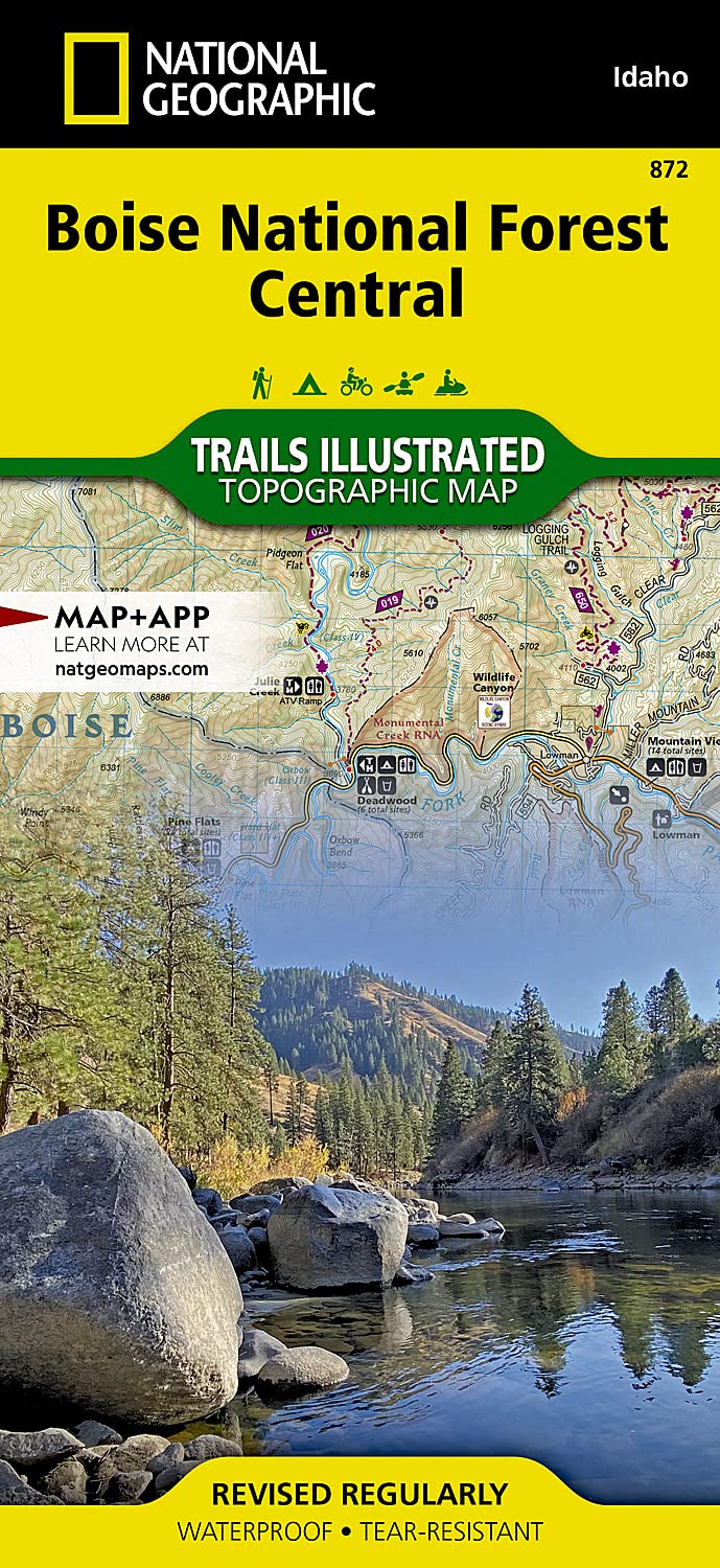
• Waterproof • Tear-Resistant • Topographic Map National Geographic's North Fork Range, Deadwood River Trails Illustrated map spans the heart of the Boise National Forest between Boise and McCall, Idaho, encompassing the North Fork Range and West Mountains on its west side, and the Salmon River Mountains to the east. This spectacular region of mountain peaks, ridges, and valleys is trisected by the North, Middle, and South Forks of the Payette River and carved further by the South Fork's main tributary, the Deadwood River, with their many whitewater stretches, hot springs, campgrounds, canyons, valleys, and meadows. The region is traversed by hundreds of miles of multi-use, multi-season trails and dotted with lookout towers, recreation facilities, and reservoirs. The west side includes the town of Cascade at the southern end of Lake Cascade, with its developed beaches, boat ramps, and picnic areas, and Sage Hen Reservoir and the KYAOTT ATV Trail network of motorized trails, plus camping on the reservoir. The more remote east side of the map includes Deadwood Reservoir, a salmon and trout-stocked lake ringed by mountains, with several campgrounds and boat ramps. The village of Lowman sits in the heart of the region, near the whitewater confluence of the Deadwood and South Fork Payette Rivers and the road junction of the Wildlife Canyon and Ponderosa Pine Scenic Byways. Lowman is central to many campgrounds, cabins, yurts, whitewater access points, and motorized and non-motorized trails used throughout the year, including the Banner Ridge, Gold Fork, and Whoop Um Up winter recreation areas and their networks of all-season trails with cabins and yurts. All trails are marked and labeled with trail mileages and uses, with steep slopes clearly indicated. Road mileages for navigating through the region are also marked and labeled to help estimate travel times. The map margins include fishing, hunting, and motorized vehicle regulations, plus contact information for local, state, and federal land and resource management agencies and Leave No Trace guidelines and ethics. Every Trails Illustrated map is printed on "Backcountry Tough" waterproof, tear-resistant paper. A full UTM grid is printed on the map to aid with GPS navigation. 27% of the proceeds from the sale of this map fund the National Geographic Society's work in the areas of science, exploration, conservation, and education. Other features found on this map include: Boise National Forest, Deadwood Reservoir, Goat Mountain, Lake Cascade, North Fork Range. Map Scale = 1:75,000 Sheet Size = 25.5" x 37.75" Folded Size = 4.25" x 9.25"
Buy products not available in the Philippines.