Galleon 2026Download our mobile shopping application for faster and easy transaction.
Product ID:
191057
Identifier:
1566953405
Brand:
National Geographic
Model:
NatGeo Maps: Trails Illustrated
Shipping Weight:
0.2 lbs
Manufacturer:
Natl Geographic Society Maps
Shipping Dimension:
7.52 x 4.02 x 0.28 inches
₱1,411
₱1,201
+ ₱ 150
Shipping Cost from USA to Philippines inclusive of custom fees.
Cost too high? Check weight and dimension on product details and click "I think this is wrong?" link.
Get it between 2026-06-04 to 2026-06-11.
Additional 3 business days for provincial shipping.
- Price and Stocks may change without prior notice
- Packaging of actual item may differ from photo shown
Cash upon Pick-up - orders grand total must not exceed ₱5,000.00. Order will be pickup at Galleon's Office.
Cash on Delivery - orders grand total must not exceed of ₱10,000.00 and must not exceed ₱5,000.00 for provincial areas. See all payment methods
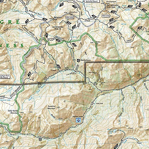
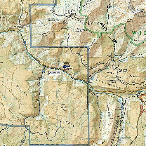
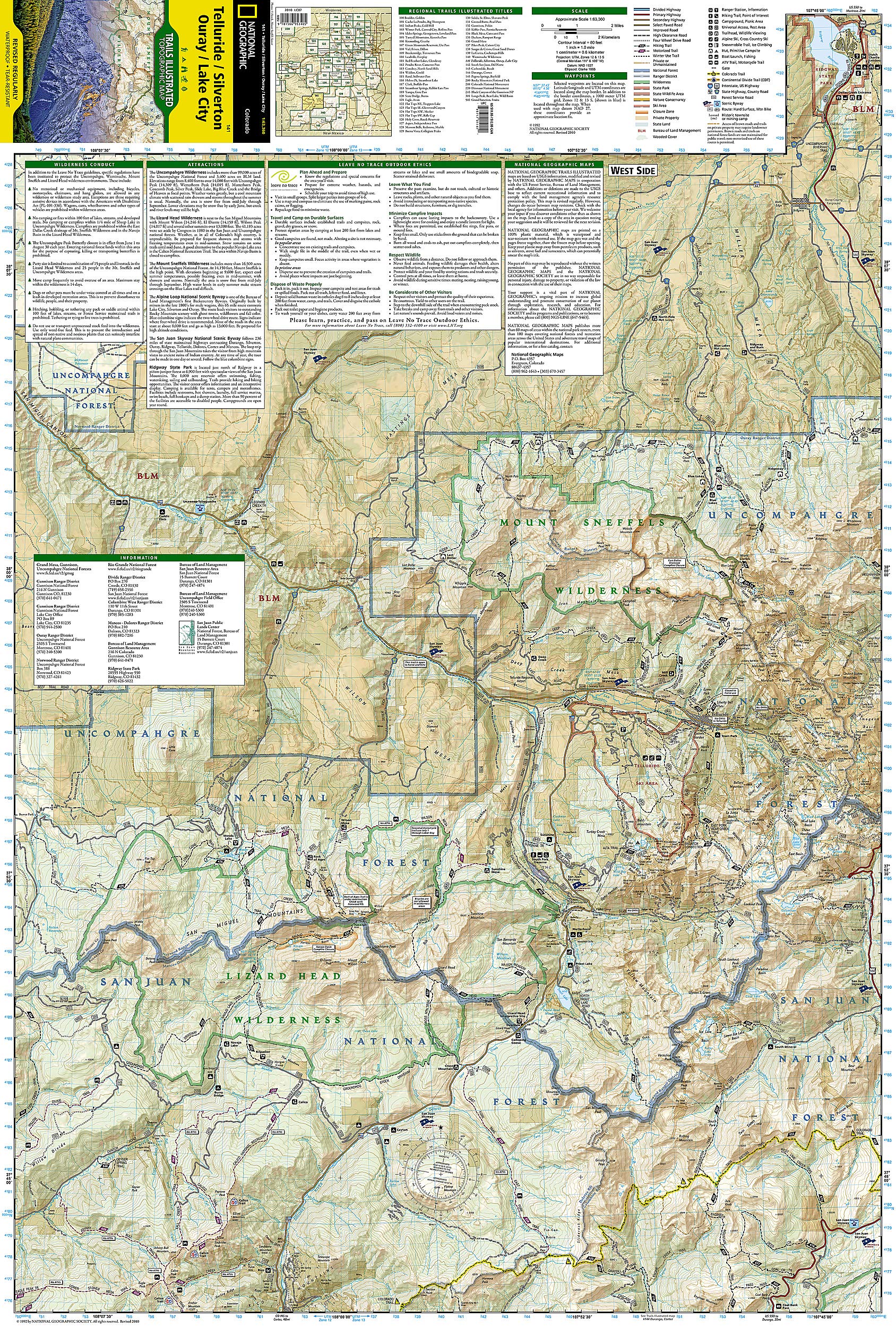
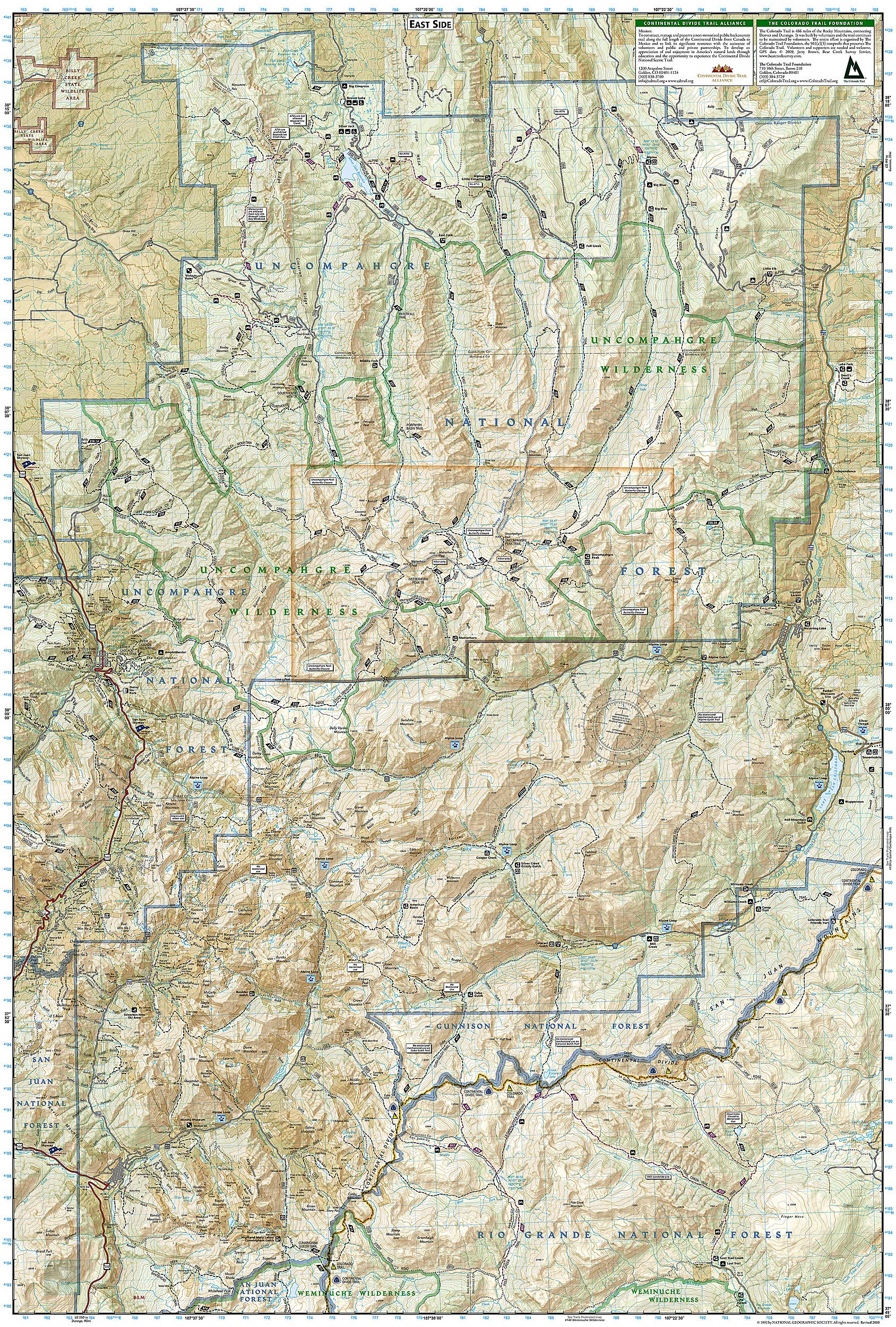
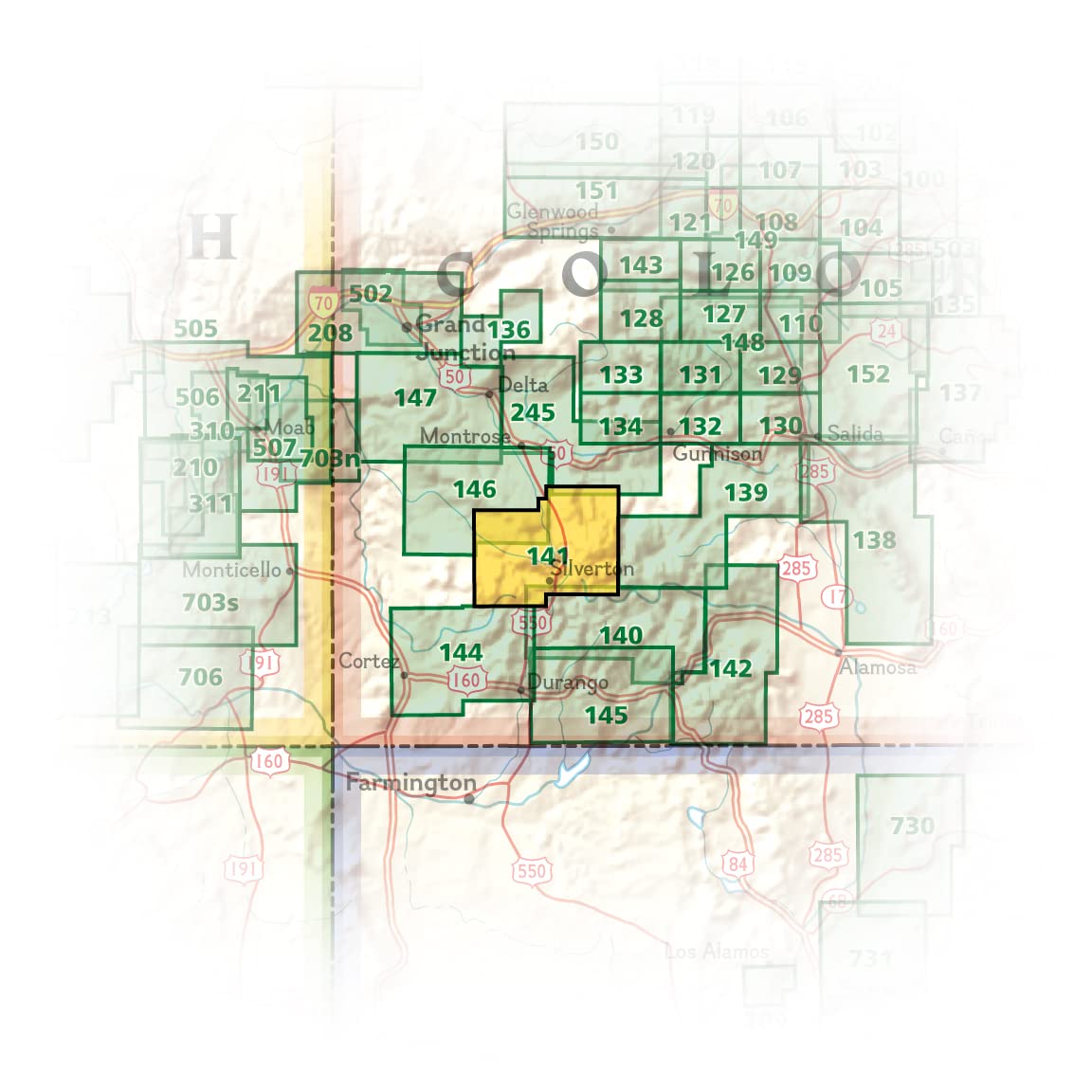
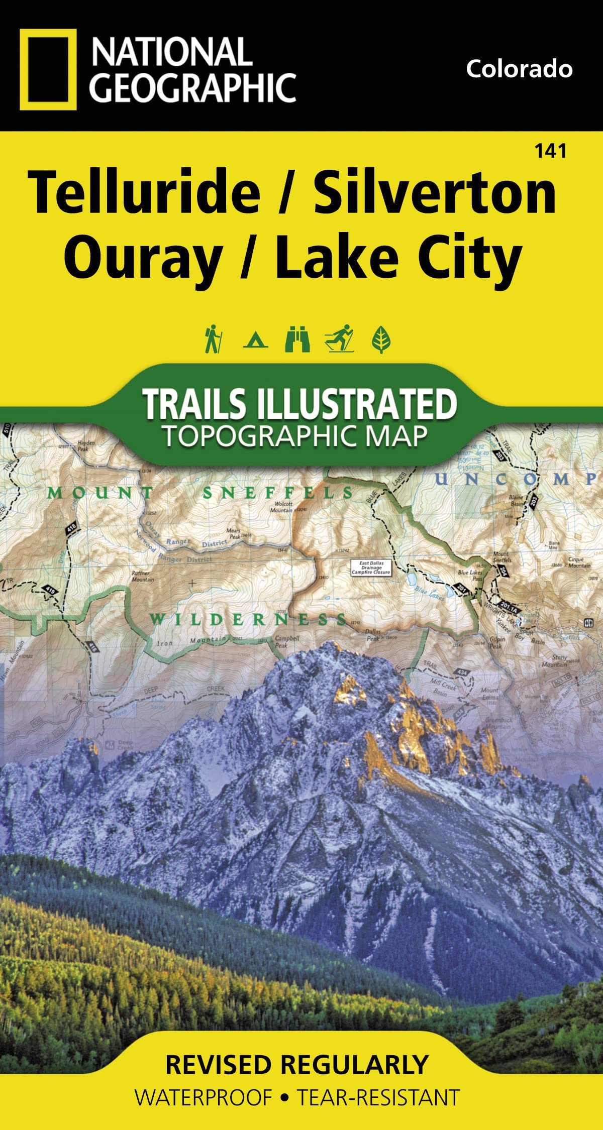
• Waterproof • Tear-Resistant • Topographic Map Expertly researched and created in partnership with local land management agencies, National Geographic's Trails Illustrated map of Telluride, Silverton, Ouray, and Lake City provides an unparalleled tool for exploring this breathtaking region of Colorado. Whatever the season, you'll find this map a useful tool in pursuing a host of recreational activities from skiing, snowmobiling, and ice climbing to camping, fishing, mountain biking, and ATVing. The map also includes information about these featured attractions: Uncompahgre Wilderness, Alpine Loop National Scenic Byway, Lizard Head Wilderness, Ridgway State Park, Mount Sneffels Wilderness, and San Juan Skyway National Scenic Byway. This map can guide you off the beaten path and back again with miles of mapped trails including the Colorado Trail and the Continental Divide Trail. The map base includes contour lines and elevations for summits and passes. Recreation features such as campgrounds, boat launches, and fishing access are clearly noted, and contact information for various agencies is included as well. Every Trails Illustrated map is printed on "Backcountry Tough" waterproof, tear-resistant paper. A full UTM grid is printed on the map to aid with GPS navigation. Other features found on this map include: Cimarron Ridge, El Diente Peak, Gunnison National Forest, Handies Peak, Lizard Head Wilderness, Mount Sneffels, Mount Sneffels Wilderness, Mount Wilson, Redcloud Peak, Rio Grande National Forest, San Juan National Forest, Sunshine Peak, Uncompahgre National Forest, Uncompahgre Peak, Uncompahgre Wilderness, Weminuche Wilderness, Wetterhorn Peak, Wilson Peak. Map Scale = 1:63,360 Sheet Size = 25.5" x 37.75" Folded Size = 4" x 7.5"
Buy products not available in the Philippines.