
We specialize in hard to find items

All Categories


Big Bend National Park Map (National Geographic Trails Illustrated Map, 225)
Share Tweet
*Price and Stocks may change without prior notice
*Packaging of actual item may differ from photo shown
- Electrical items MAY be 110 volts.
- 7 Day Return Policy
- All products are genuine and original
- Cash On Delivery/Cash Upon Pickup Available


Big Bend National Park Map Features
-
National Geographic Big Bend National Park #225 by Texas - TI00000225
About Big Bend National Park Map
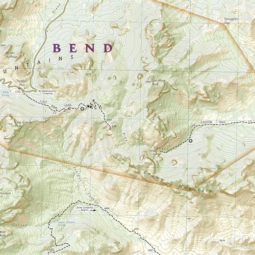
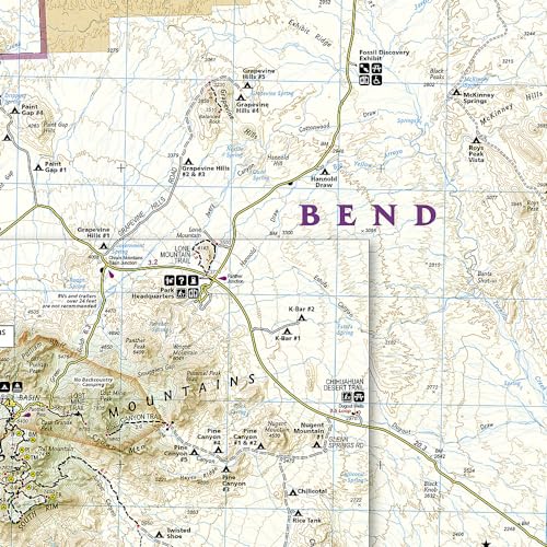
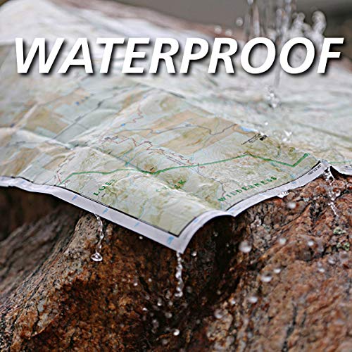
• Waterproof • Tear-Resistant • Topographic Map The largest protected area of the Chihuahuan Desert, Big Bend National Park is a remote land of surprising beauty and remarkable biodiversity. Expertly researched and created in partnership with local land management agencies, National Geographic's Trails Illustrated map of Big Bend National Park provides an unparalleled tool for exploring this unique region. This map offers unmatched detail of the entire park including such key areas of interest as Black Gap Wildlife Management Area, Sierra del Carmen, Sierra del Caballo Muerto, and portions of Big Bend Ranch State Park. The print map features detail of the Chisos Mountains, Rio Grande Village, and Burro Mesa. Hiking and primitive trails are clearly marked and the Chisos Mountains detail provides mileages between intersections. Road types are differentiated, so you know if the route you choose is a paved, dirt, four-wheel-drive, or high-clearance road. River mileage on the Rio Grande is noted as well, for those exploring by boat. The map base includes contour lines and elevations for summits. Helpful information about backcountry use, regulations, wildlife, and safety tips combined with a chart showing the location of designated backcountry campsites will prove invaluable in your exploration of the park. Other recreation features noted are campgrounds, picnic areas, points of interest, scenic viewpoints, interpretive trails, and lodging. Every Trails Illustrated map is printed on "Backcountry Tough" waterproof, tear-resistant paper. A full UTM grid is printed on the map to aid with GPS navigation. Other features found on this map include: Big Bend, Boquillas Canyon, Chalk Mountains, Chilicotal Mountain, Chisos Mountains, Christmas Mountains, Dagger Mountain, Emory Peak, Ernst Valley, Mesa de Anguila, Rosillos Mountains, Sierra del Carmen, Stairway Mountain, Sue Peaks, Terlingua Creek. Map Scale = 1:133,333 & 1:27,500 Sheet Size = 37.75" x 25.5" Folded Size = 4.25" x 9.25"


