
We specialize in hard to find items

 (4)
(4)

of brand new stock?
or
Need this item ASAP?
Check if this is available on Amazon
or available in other sites
Send us the link so we can buy for you


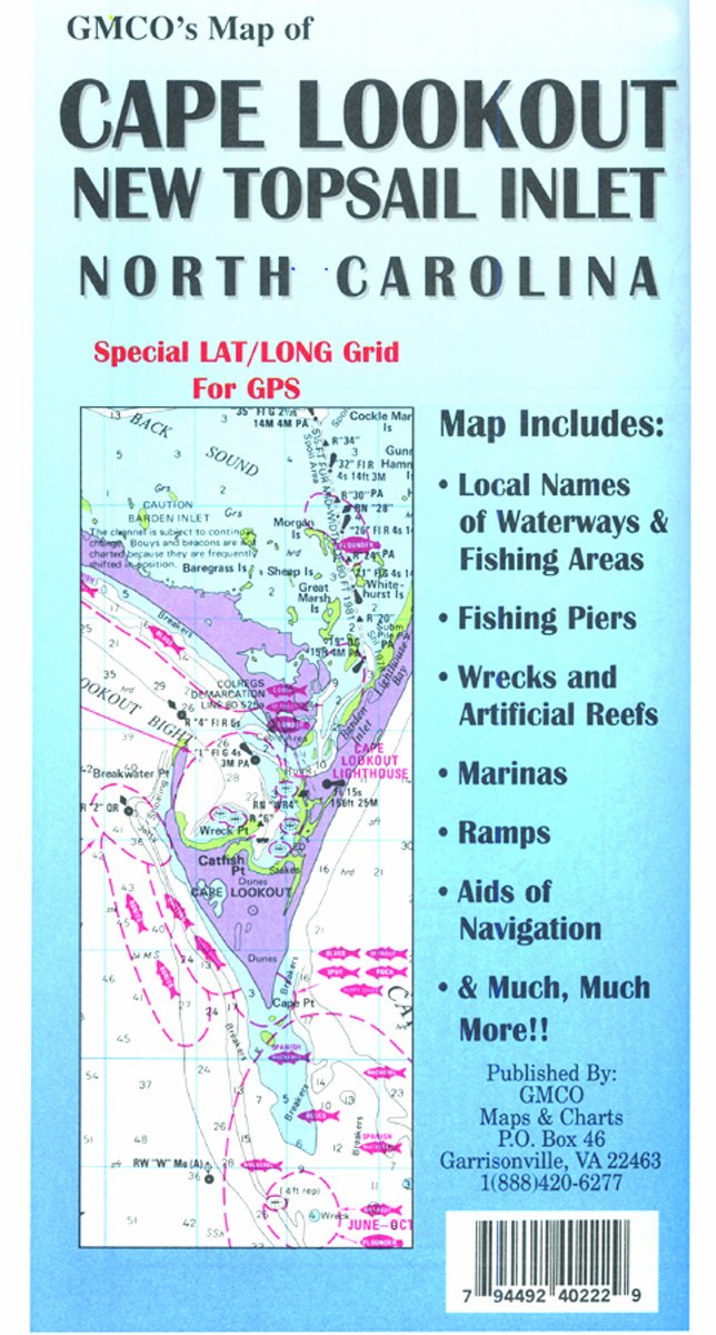
GMCO Cape Lookout Map, New Topsail Inlet, North Features
-
Includes navigational aids, wrecks and artificial reefs, fishing piers, 1-minute latitude and longitude grid for GPS and more
-
GMCO provides informative and useful maps and charts for the waters to consumers
-
Quality craftsmanship and materials make this product a must have for any fisherman
-
Country of Origin:United States
About GMCO Cape Lookout Map, New Topsail Inlet, North
The GMCO 40202 Cape Lookout Map, New Topsail Inlet, North Carolina, Folded. This Cap Lookout Map includes navigational aids, wrecks and artificial reefs, fishing piers, 1-minute latitude and longitude grid for GPS, local names of waterways and fishing areas, launching ramps and marinas and much more. GMCO provides informative and useful maps and charts for the waters to consumers.


