
We specialize in hard to find items

All Categories


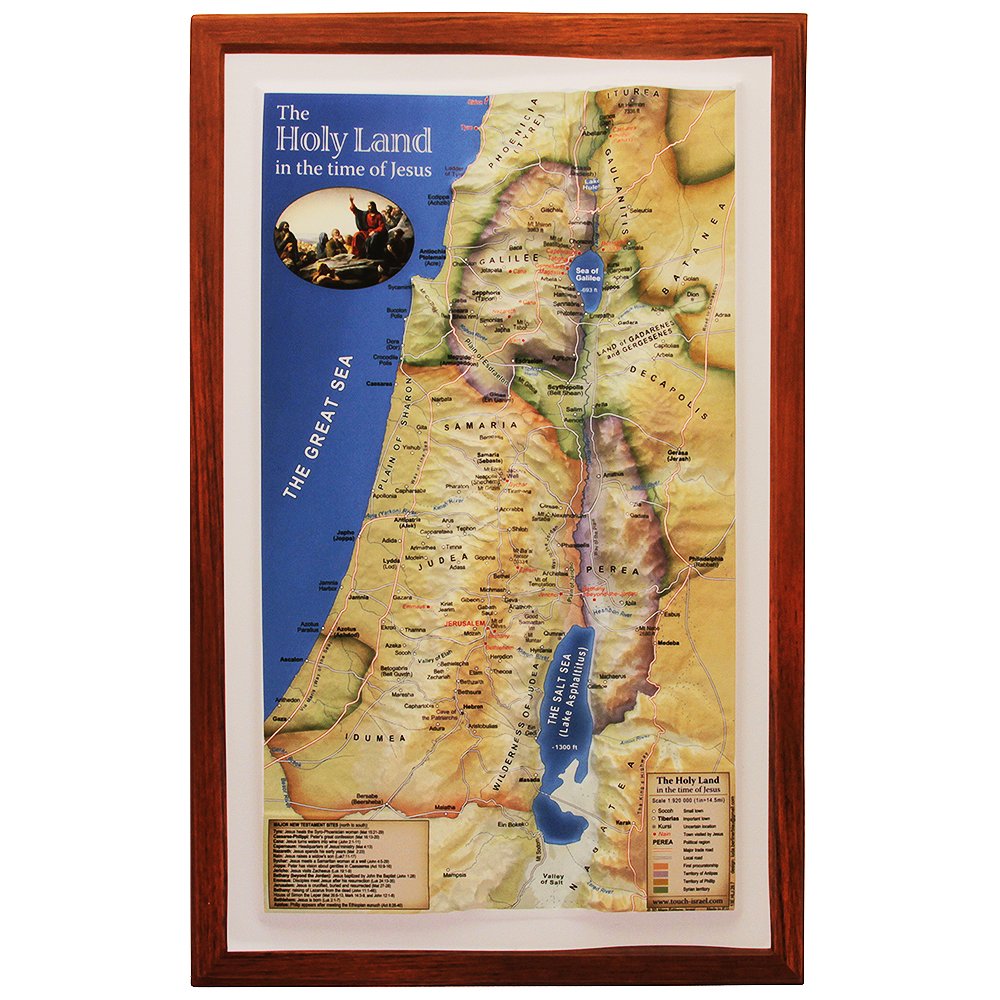


Raised Relief 3D Map of Israel in Jesus' Time (Shows Place Names Under Roman Rule)
Share Tweet
*Price and Stocks may change without prior notice
*Packaging of actual item may differ from photo shown
- Electrical items MAY be 110 volts.
- 7 Day Return Policy
- All products are genuine and original
- Cash On Delivery/Cash Upon Pickup Available


Raised Relief 3D Map of Israel in Jesus' Time Features
-
🗺️ Experience ancient Israel in 3D: Meticulously crafted raised relief map brings the landscape and culture of the Holy Land during Jesus' time to life with intricate topographical details.
-
📚 Historically accurate: Features Roman place names, surrounding territories, and significant landmarks, providing a unique educational resource for exploring the world as Jesus and his contemporaries knew it.
-
🎨 Stunning display piece: Measuring 24" x 18", this beautifully designed map is perfect for home, office, or classroom use, inviting conversation and reflection on Israel's rich history.
-
🔍 Key locations highlighted: Easily trace the footsteps of Jesus and other prominent figures with highlighted sites like Jerusalem, Bethlehem, Nazareth, and the Sea of Galilee.
-
🎁 Perfect gift for history buffs: Ideal for educators, travelers, and enthusiasts, this 3D raised relief map is an invaluable resource and unique piece of art that captures the essence of ancient Israel the Holy Land
About Raised Relief 3D Map Of Israel In Jesus' Time
Introducing our meticulously crafted 3D Raised Relief Map of Israel during the time of Jesus, a must-have piece for history enthusiasts, educators, and travelers alike! This striking, high-quality map brings the Holy Land to life, illustrating the landscape and culture of the region during the Roman Empire in vivid detail. Measuring 14" x 9.5" (36 cm x 23 cm), the map showcases Roman place names, surrounding territories, and significant landmarks, all presented in full color. With its intricate 3D topography, you'll feel the elevation of the hills and valleys, gaining a deeper appreciation for the terrain that shaped the history of this ancient land. The map also highlights key locations such as Jerusalem, Bethlehem, Nazareth, and the Sea of Galilee, enabling you to follow the footsteps of Jesus and other prominent figures of the time. In the office, Home, or classroom, inviting conversation and reflection on the rich history of Israel and the Holyland and its significance to millions of people around the world Order yours today and embark on an unforgettable journey through time!


