
We specialize in hard to find items

All Categories


Boundary Waters West Map [Canoe Area Wilderness, Superior National Forest] (National Geographic Trails Illustrated Map, 753)
Share Tweet
*Price and Stocks may change without prior notice
*Packaging of actual item may differ from photo shown
- Electrical items MAY be 110 volts.
- 7 Day Return Policy
- All products are genuine and original
- Cash On Delivery/Cash Upon Pickup Available


Boundary Waters West Map [Canoe Area Features
-
Trails Illustrated Map: Boundary Waters West
About Boundary Waters West Map [Canoe Area
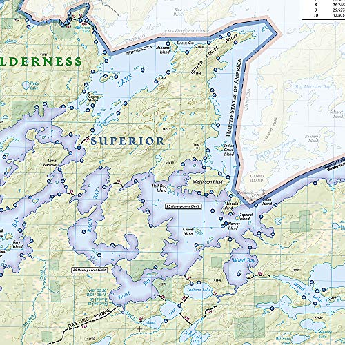
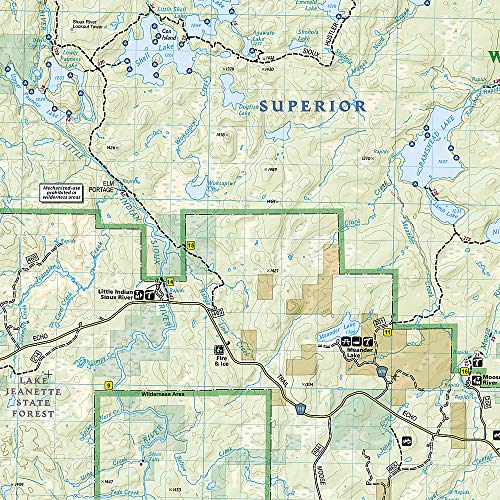
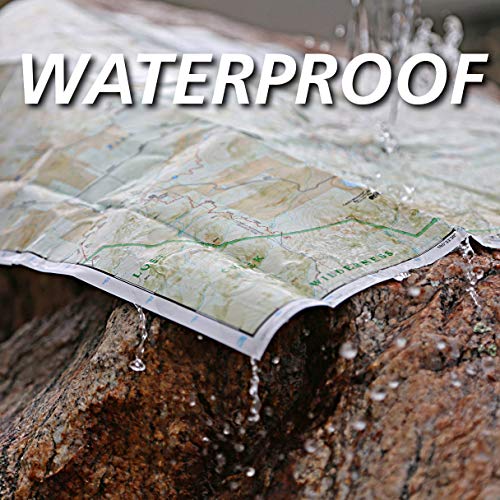
• Waterproof • Tear-Resistant • Topographic Map With over 1,500 miles of canoe routes, nearly 2,200 designated campsites, and more than 1,000 lakes and streams waiting, the Boundary Waters Canoe Area Wilderness draws over 250,000 visitors each year. National Geographic's Trails Illustrated map of Boundary Waters East delivers unmatched detail and valuable information to assist you in your exploration of this breathtaking wilderness. Created in partnership with local land management agencies, this expertly researched map features key areas of interest including the International Wolf Center; Echo Trail roadway; Burntside, Vermilion, Trout, and Snowbank lakes; Little Indian Sioux and South Kawishiwi rivers; Kekekabic Trail; and Taconite State Trail. In addition to detailed and easy-to-read hiking, bike, ATV, and snowmobile trails, this map includes an accurate road network, international customs points, regulations, and contact information for local agencies. Boaters will find the information on watercraft horsepower restrictions and the conversion table for distances handy. The map base includes contour lines and elevations for summits, passes and many lakes. Recreation features are clearly marked, including campgrounds, trailheads, interpretive trails, swimming and beach access, fishing areas, carry down access, and boat launches. Every Trails Illustrated map is printed on "Backcountry Tough" waterproof, tear-resistant paper. A full UTM grid is printed on the map to aid with GPS navigation. Other features found on this map include: Basswood Lake, Boundary Waters Canoe Area Wilderness, Crooked Lake, Lac la Croix, Superior National Forest, Trout Lake, Vermilion Lake. Map Scale = 1:70,000 Sheet Size = 25.5" x 37.75" Folded Size = 4.25" x 9.25"


