
We specialize in hard to find items

All Categories


Kachemak Bay State Park Map (National Geographic Trails Illustrated Map, 763)
Share Tweet
*Price and Stocks may change without prior notice
*Packaging of actual item may differ from photo shown
- Electrical items MAY be 110 volts.
- 7 Day Return Policy
- All products are genuine and original
- Cash On Delivery/Cash Upon Pickup Available


About Kachemak Bay State Park Map
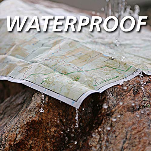
• Waterproof • Tear-Resistant • Topographic Map Outdoor enthusiasts exploring the various public recreation lands in the southwestern part of the Kenai Peninsula will find National Geographic's Trails Illustrated map of Kachemak Bay State Park an essential travel companion. This expertly researched map was created in cooperation with the National Park Service, Alaska State Parks and others. Coverage includes Kachemak Bay, State Park and Wilderness Park; Kenai Mountains, National Wildlife Refuge and Wilderness; southwestern Kenai Fjords National Park; Sterling Highway and its many recreation areas, from Soldotna to Homer; Tustumena Lake; and Cook Inlet. Navigate around the area by following along mapped highways, roads and various trails, including trails crossing private lands or with the aid of pinpointed seaplane bases, kayak landing beaches, mooring buoys and anchorage sites. Hiking trails are shown with mileage markers between intersections. Your expedition will be aided by displayed contour lines, elevations, peaks, summits, water features, glaciers, selected waypoints and clearly labeled areas of private, public and native lands. Recreation features include campgrounds, campsites, public cabins, picnic areas and shelters, boat launches, fishing holes, cross-country ski areas, potable water and water sources that require treatment. Essential park information is also provided, including background information, safety tips, points of interest, park guidelines and contact information. Every Trails Illustrated map is printed on "Backcountry Tough" waterproof, tear-resistant paper. A full UTM grid is printed on the map to aid with GPS navigation. Other features found on this map include: Anchor Point, Chugach Islands, Fox River, Gore Point, Kachemak Bay, Kalgin Island, Kenai Fjords National Park, Kennedy Entrance, Nuka Bay, Nuka Island, Point Adam, Point Pogibshi, Port Dick, Tustumena Lake. Map Scale = 1:110,000 Sheet Size = 37.75" x 25.5" Folded Size = 4.25" x 9.25"


